
A Journey Through Reigate's Past - South of the Town
 1 |
 2 |
||||
|
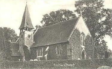
Sidlow Church stands amid the Surrey countryside not far inside the southernmost boundary of the Borough of Reigate and Banstead. |
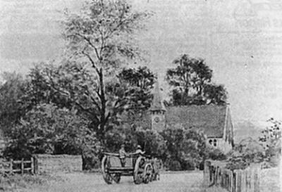
This painting shows a cart going over the river bridge close to the church in a scene that reminds us of the slower pace of life in days gone by. |
||||
This is how the Beehive pub on the Doversgreen Road looked until 1929. Stephen Burberry owned it when Westerham Ales took it over in 1890 but it seems that the Burberry family continued to run it as a report of an 1895 fire there says, "Two part boarded and brick house, one used as post office the other as a beer house, was well alight with roof falling in when brigade arrived. Fire caused by Mrs Burberry ascending stairs with parffin lamp, catching foot in stair carpet and falling. Paraffin spilt and ignited house." From 1909 to 1949 the Burberry family ran the pub in the white boarded side and lived in the brick side. In 1949 it was taken over by Allied Breweries. |
|||||
 4 |
 5 |
||||
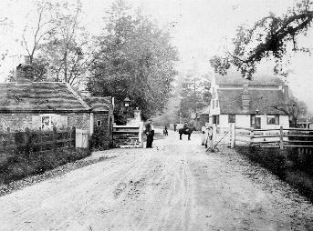
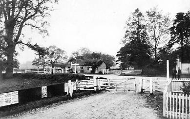
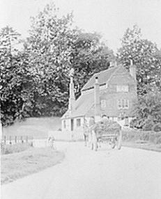
The toll gate that once stood on the Doversgreen Road. The Angel pub is in the background. |
Further tollgates stood nearby at the junctions with Earlswood Road and Prices Lane. Here the Angel pub is just out of sight on the right and all three gates can be seen. |
||||
 6 |
 7 |
||||
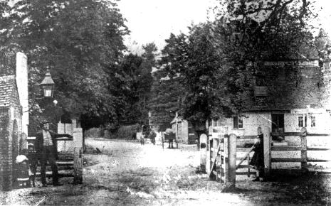
Two more pictures of the toll gates viewed from the south |
|||||
 8 |
 9 |
||||
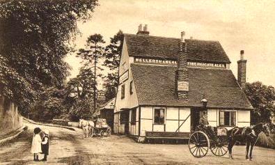
Two pictures of the Angel public house, the first from the south the other from the north, with the horse and cart heading towards Reigate. |
|||||
 10 |
A horse and cart approaches the Angel pub in the days when the road from the east was less than half the width it is today. Notice that some of these pictures show the Angel public house before it was extended on its eastern side. |
||||
 11 |
 12 |
||||
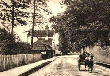
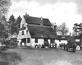
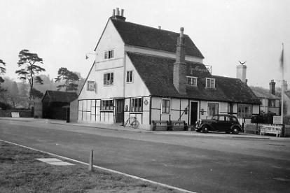
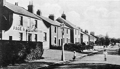
Two more pictures of the Angel. The one on the left was on one side of a presentation by White, Tompkin and Courage, Ltd. of Reigate. On the other side is the information that it was not used as an inn until c1700, when it was called 'The White Horse', and the name was changed to 'The Angel' in about 1814. The right-hand picture shows the pub years later in the 1930s, with the form of transport much changed. (1930s picture courtesy John Eede) |
|||||
 13 |
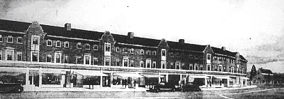
An atist's impression of Western Parade in Prices Lane. The shops were built on farmland west of the junction with the Doversgreen Road and Prices Lane in 1936. They were advertised as serving a large area as this was a time of considerable building locally, with houses selling from £535 upwards. The Angel pub is far right. |
 14 |
||
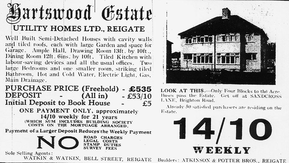
An advertisement from 1934 for houses on the Hartswood estate. |
||
 15 |
 16 |
|
There is no longer a permanent
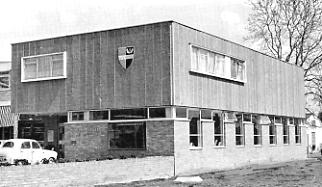
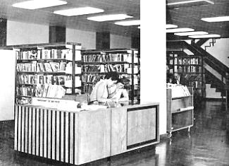
library at Woodhatch but here it is as it was in 1971 Picture required of building as it is now |
||
 17 |
 18 |
|
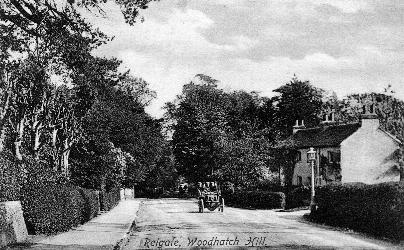
This car is halfway up the hill that starts close to the Angel pub; it is just passing cottages on the corner with Old Pottery Close |
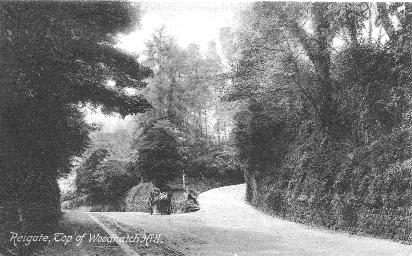
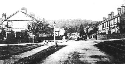
The top of Cockshot Hill. The road on the right is Park Lane East, the entrance to South Park. |
|
Detour into South Park |
||
 19 |
 20 |
|
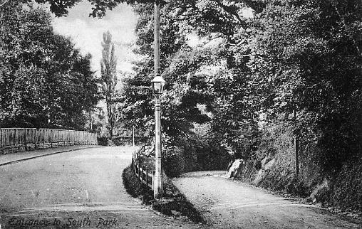
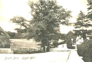
If, instead of continuing to Reigate town, the horsedrawn cart shown in the previous picture were to take a detour along the road to South Park it would have to descend into that small village by the part of Park Lane East known as Light Hill, and shown here on the left. The road on the right was made as a more even gradient for vehicles coming up and now exists only as a footpath. |
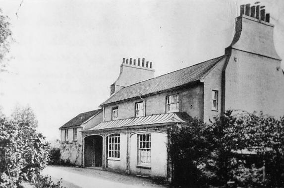
To get to the point shown in the previous picture the driver of the cart would have just passed Cocks Hut on his left, a large house built c1800 and formerly known as Bellevue or Belleview. There is a story that the Prince Regent accompanied by Lady Fitzherbert once stopped here on his way to Brighton. |
|
 21 |
 22 |
|
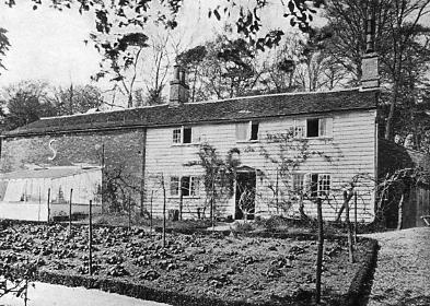
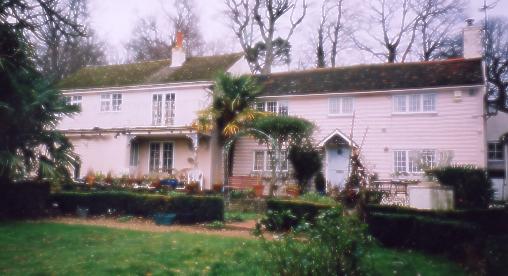
Cocks Hut Cottage is close by Cocks Hut. The brick built left hand side of it was once stables and stable lad's accomodation |
Cocks Hut Cottage in January 1904. The right hand side is much as it was but the left side has been demolished and rebuilt with greater height. (Picture and information courtesy the property owner) |
|
 23 |
 24 |
|
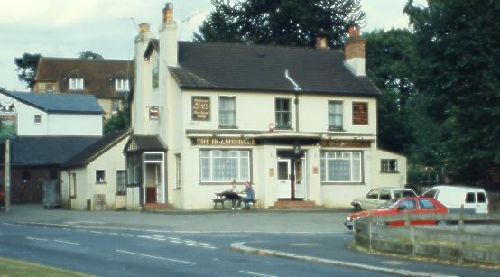
If the driver continued to the foot of Light Hill he would have been able to quench his thirst at the Holmesdale pub, pictured here in 1993. |
The Holmesdale was subsequently demolished and redeveloped; the facing houses occupy its old site in this 1998 picture. |
|
 25 |
 26 |
|
This early 190% picture of Light Hill was taken from a slightly different angle to the previous one so that the farmland on the left is visible. The Holmesdale pub sign stands inside a hedge that once formed part of its perimeter. |
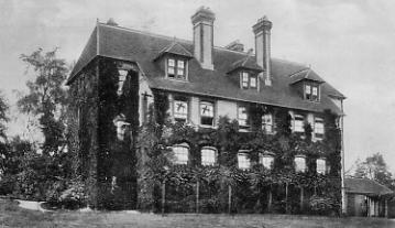
This is the back of the Croft Home, an annexe to the London Hospital in Church Road, South Park, which is a hundred yards or so on the right up the hill in the picture on the left. This picture is from a postcard sent to Stoke Newington in 1935 by the sender, Dorothy, who was convalescing in the country. In the message she refers to 'a glorious view across 20 miles of country' from her windows, which she has marked with crosses on the card. Many other cards of the home exist, many of them referring to it as Mrs Kitto's convalescent Home, as it was called in years previous to the date of the above card. |
|
 27 |
 28 |
|
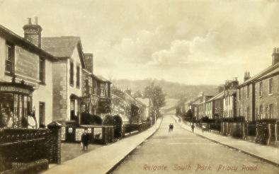
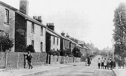
Priory Road, South Park, looking west in the early 190%s. The field seen at the road's end is the one also shown in the above picture. The grocery shop in the left foreground was that of the Reigate Industrial Provident Society, which was succeeded by the South Suburban Co-operative Society in 1936. Next to the grocer's a lane led to Durrant & Sons Brewery. Trees a little further along the street belonged to an orchard on ground later built on. By the lamppost on the left were Port's the Bakers and Lilley's butchers shop. |
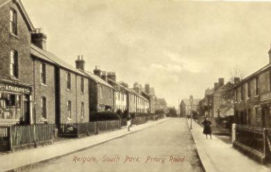
Turn the camera around and we have Priory Road looking East. Port's bakery and the orchard referred to in the previous picture are on the right while the shop on the left is Albert Truelove's general store. |
|
 29 |
 30 |
|
A longer view of Priory Road looking east. The tree on the right was just one of a line that once extended to Park Lane East |
The Barley Mow in Eastnor Road was run by Mary Matthews from 1937 until the mid-70s. Many people will remember it as a true character pub with benches around rough tables, and glasses and some of the beer in bottles on wooden shelves on the back wall. |
|
 31 |
||
Eastnor Road stretches away towards Park Lane, the Barley Mow being along on the right. The road crossing is Allingham Road and the road from which the picture was taken is Stockton Road. The corner plots either side have been built on for many years. |
||
 32 |
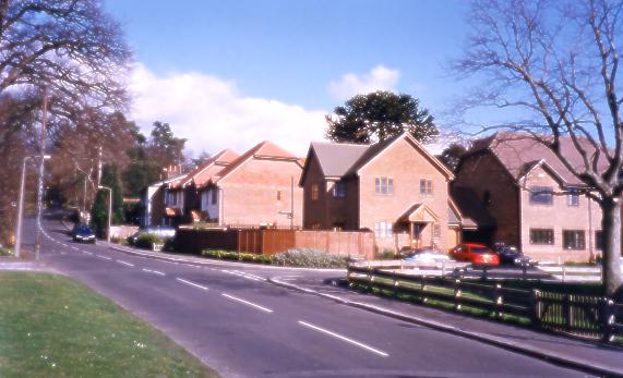
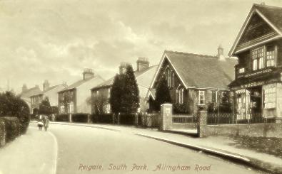
Picture of Allingham Road as it is today to go here |
|
Allingham Road, South Park. The Congregational Church stands next tothe Post Office, which at this time was also a drapers and tailors run by the Hood family. |
||
These pictures of South Park were either taken by the author or are from the postcards that are in, or were once in, the author's own collection. Similar pictures and many others appear in a lovely little book called 'Memories of South Park' published by June Wilcox in 1996, ISBN 0 9528792 0 4 . June came to South Park with her husband in 1969, the same year as this author moved out of Stockton Road and away from South Park. |
||
Now we return to the top of Cockshot Hill and continue into Reigate |
||
 33 |
 34 |
|
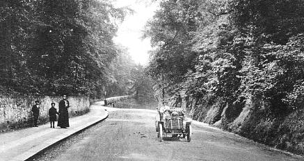
From the top of Cockshot Hill the road descends into Reigate and becomes Bell Street. Sand pits dug on the right and a large quarry at the top of the hill on the left are now the site of housing. The top of the hill in the background can be seen level with the car driver but a narrow access road ascends on the left to a large house called Isbells, near where two windmills once stood. |
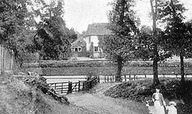
As the car on the left travelled a few yards further it would pass one of the entrances to Reigate Park. These two ladies were pictured leaving the park in 1894. |
|
 35 |
 36 |
|
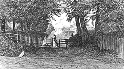
A drawing of the gates from an even earlier time |
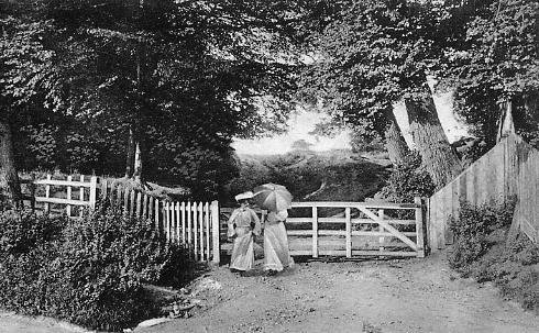
A picture of the same entrance c1910. It can be seen that tree on the right have been felled |
|
 37 |
 38 |
|
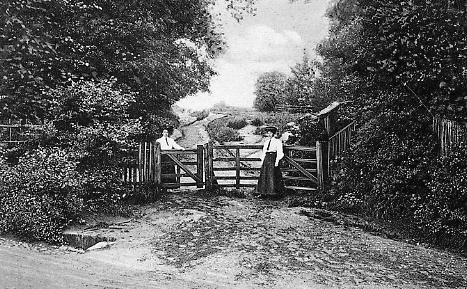
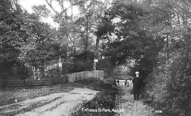
A look at the gates from the other direction showing the road. By the time this picture was taken even more trees had been felled. |
This picture from further into the park explains the fence visible in the picture on the left. It dates from the days when the Reigate Park, now sometimes called Priory Park, was open to the public but the Priory and its grounds were privately owned and were separated by the fence. The Priory building is now a school and its grounds and the park are all part of the same area with public access. |
|
 39 |
||
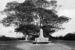
If one were to continue up the path in the previous picture onto the top of Priory Park the memorial to Reigate resident Mr Randall Vogan (also remembered in the naming of Vogan Close) would be arrived at. In 1922 he purchased and presented to the Corporation Reigate's most notable landmark, the Old Town Hall, which occupies a central position in the Market Place. This picture of it dates from 1937. |
||