

Redhill as it once was and as it is today - The High Street
This is the second of the 'Then and Now' pages. It features the High Street from the days before living memory to the present time. Like other parts of the town the High Street has undergone considerable redevelopment. Hopefully ex-Redhill people who have lived elsewhere for some years can look at these scenes with pleasant memories although they're sure to notice significant changes. But in 2004 the town has been undergoing even more change, with a 'revamping' scheme undertaken by the Borough Council - even the town centre, for years known as The Market Place, is to be renamed, For the latest changes see the end of this page. We start, however, with pictures from days long gone by.
 |
 |
|
|
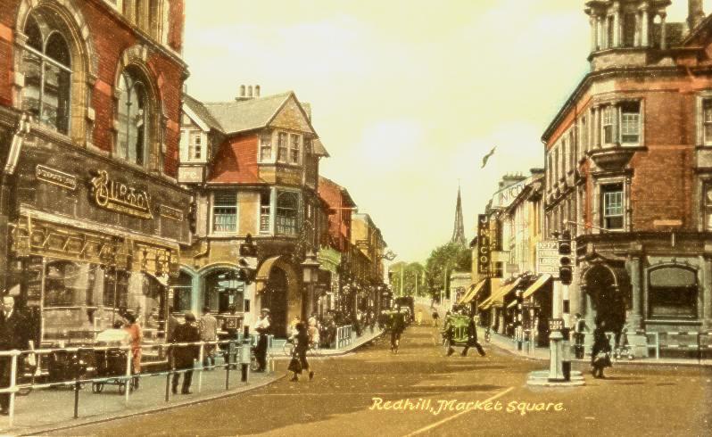
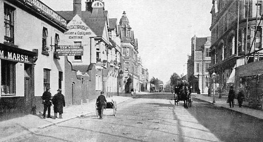
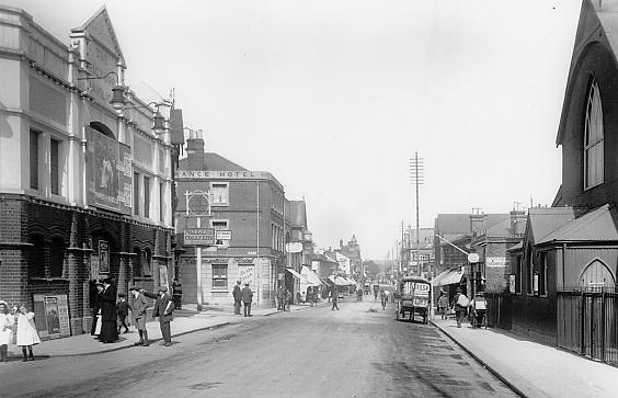
The High Street seen from the crossroads as probably no one living will remember it as the picture dates from 190% - 1904. The Wheatsheaf pub is familiar but further down on the right hand side is Sam Marsh's stables, which was replaced by Woolworths many years ago. In the distance is St Joseph's Church, demolished in the early 1990s. Just beyond the church is Reading Arch when it was an arch, something that changed when it was widened in about 1904 |
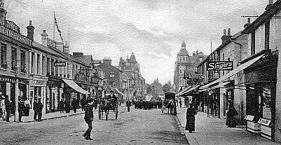
Here we move forward in time. On the left the view in the 1920s, with the distant Reading Arch now just a steel bridge. Nicols' shop is still on the left and there's a little more traffic, in this period still directed by a policeman, although none is obvious in this view. |
|
 |
 |
|
|
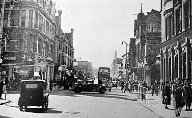
Forward in time again, this time to the 1950s. There is much more traffic, with lights installed to control it and railings put up to control pedestrians. Burton's shop has replaced Nicols. Much of he town's redevelopment occurred in the following three decades. |
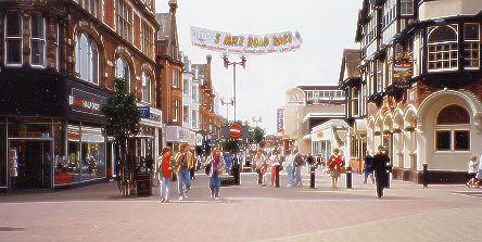
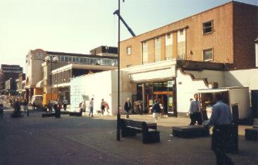
1993 and the scene has changed dramatically. Many of the old buildings still stand but the area from Clarendon Road South to Cromwell Road, and from the Arcade to Warwick Road, has become pedestrianised. The town now has a one-way system encircling it which has removed all of the traffic from the main shopping area. Woolworths is visible and beyond it the new Belfry shopping precinct (more pictures of that later). |
|
 |
 |
|
|
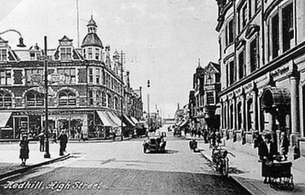
The centre of Redhill c1948 viewed from Station Road East; turn right for London, left for Brighton. |
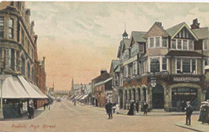
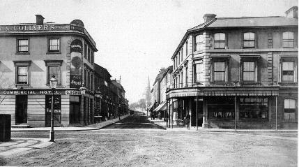
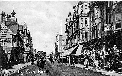
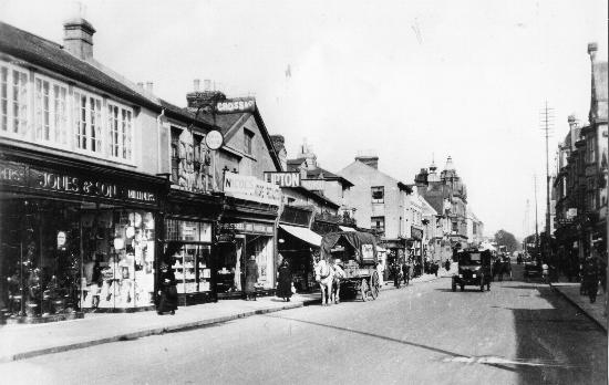
The centre of Redhill c1890. The Wheatsheaf pub and the butchers shop on the opposite corner (now Lloyds Bank) were both rebuilt c190% |
|
 |
 |
|
|
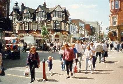
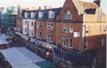
Here we look from a similar angle as the above photo across the now pedestrianised town centre where the crossroads once were. Here the High Street is to the left with market stalls just visible where traffic once waited at the lights outside the Wheatsheaf. |
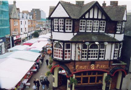
The Wheatsheaf when renamed the Firlot and Firkin in the late 1990s, although since then it has again renamed, this time to O'Neills. This view looks south, down the High Street, over the covered stalls of the thrice-weekly market. Some of the old buildings remain but further down there have been changes. |
|
 |
 |
|
|
A view looking back towards the town centre crossroads from the north end of the High Street at about the point where the market stalls end in the last picture. It by far pre-dates that picture, of course, being from just after the turn of the 190%s. Sam Marshes stables, mentioned in the first picture above, are on the left. Nicol's shop is on the right with the Market Hall just visible on the other side of Station Road East. Note that buildings on the east side of the street are in course of erection. |
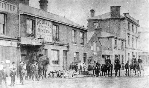
Early as the picture on the left might be this picture is even earlier. It shows the stables in the picture on the left when they were owned by Mr Marsh's predecessor, Mr Robins, at the end of the 19th century. Strange to think that huntsmen and hounds might have set out from Redhill High Street but it looks like they did. The taller building on the right behind the horsemen is the original Wheatsheaf pub as it was before it was rebuilt in 190%. To orientate the picture further, Woolworths now occupies the stables site. |
|
|
 |
|
|
A view similar to above of the of the High Street in the early 190%s with the buildings on the right now completed. |
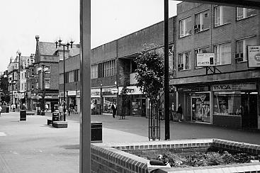
The east side of the high Street in the 1990s, with the same perspective as the picture left but now with flowers beds, and in the distance the Harlequin complex that replaced the Market hall can be seen. |
|
 |
 |
|
|
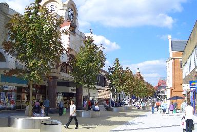
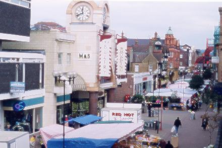
Here's a picture of this part of the High Street as it is today (2005) looking south, with Maple trees down its pedestrianised centre. The Wheatsheaf pub, now called O'Neills' is on the right. Woolworths, built on the site of the stables shown above, is a little further down on the right. |
And here are the trees again, this time looking north towards the town centre with the dome of the Belfry shopping mall dominating the west side of the street. The green dome in the distance is on the Lloyds bank building on the sorner of London Road and Station Road West. |
|
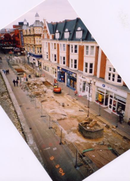
Picture left shows the preparation for the planting of the trees in the High Street in March 2004. Drains and pipes were arranged to carry surface water to the roots. . Before leaving this part of the High Street the pictures below show the rebuilding of this building (nos.2-12 High Street) in 1999 |
||
 |
 |
 |
||
|
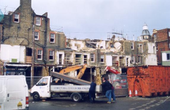
Here's the building as it was before work started. |
Demolition started at the rear. |
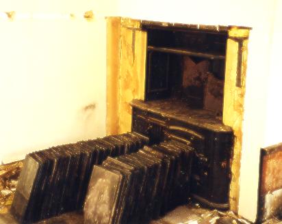
This old stove was discovered behind a 2nd floor false wall. Here it has roof tiles leant against it. The demolition men expected to get £500 for it. |
||
 |
 |
 |
||
|
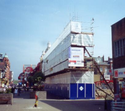
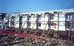
The scheme included the retention of the facade of the building. There must have been a reason for this because the work involved in keeping it cost much more than complete demolition and rebuild in the same style would have done, and when finished much of its upper part was rebuilt anyway. |
The finished job. A new bulding resembling the old one. |
|||
 |
 |
|
|
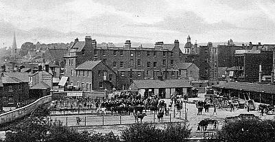
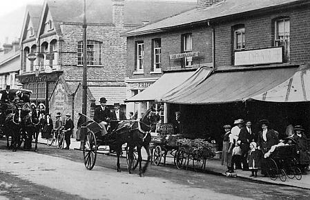
Until the late 1940s a cattle market was held fortnightly behind the shops on the east side of the High Street. A common sight in the town was animals being driven along the High Street to and from the market as in the left hand picture, which dates from c1905. The market is shown in progress in the right hand picture; the distant church spire is that of St Matthew's in Station Road West. |
||
 |
 |
|
|
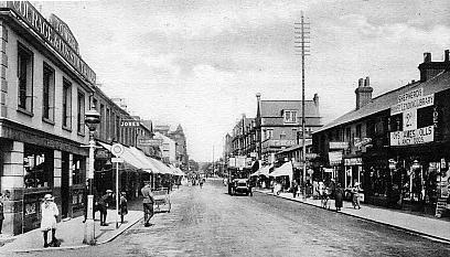
This picture dates from the late 20s or early 30s and shows the shops that existed further along its east side until the late 60s - early 70s; shops such as Greenwoods and Shepherds (later Joliffes). The telegraph poles seen were not for local 'phones but carried the London to Brighton telephone trunk route. (The Tower Pub is above, see the change in pictures below) |
The view is from the same spot as on the left, but in 1993. The buildings closer to the town centre are the same but those further south have been replaced. The pedestrianised area of the town ends here at the junction with Cromwell Road. |
|
 |
 |
|
|
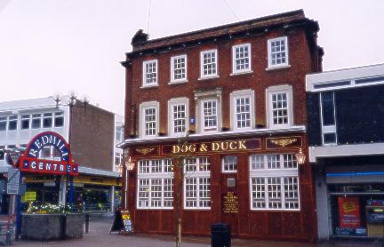
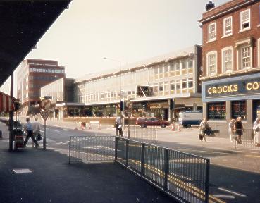
The Tower pub, only two storeys high in the above picture was rebuilt and is now three storeys. It was firstly renamed Crocks, then The Office, and is now the Dog and Duck. In spite of the redelvelopment that went on around it it survived and is one of the few old Redhill buildings left. |
Jimmy Bridger, nearest the camera, and his brother John in their Redhill shop, which was three quarters of the way along the west side of the High Street as seen in the above picture. The shop was called Latty's. Their mother originally had the shop in the 1930s and when overpainting the original sign intended to paint in the new name as 'Lotty's' but ran out of paint before the letter a was changed. The shop closed in the mid-1960s and was demolished in 1966. |
|
 |
 |
|
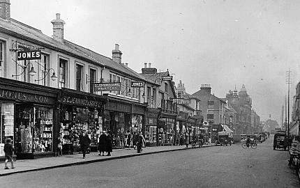
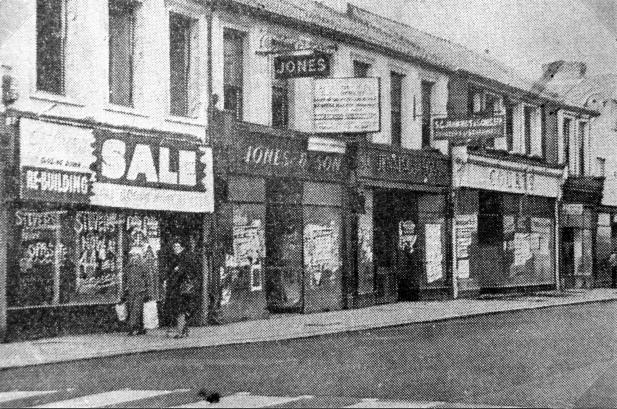
Two views of the west side of the High Street mid-1920s. In the left hand photo Jones seems to have just the one shop at 29 High Street but in the right hand one they have expanded into Berrett's old premises at nos. 23 and 25, where they are listed in the 1927 Street directory. (William Berrett lived at Oakdene House, Upper Bridge Road, and died in 1930 aged 83) |
|
 |
 |
|
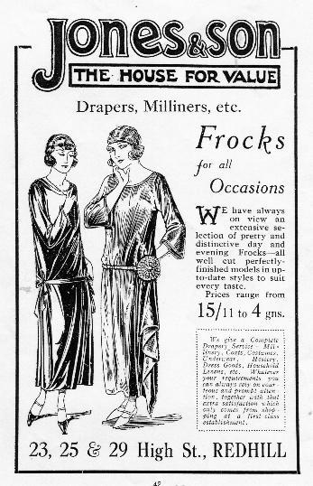
1924 advert |
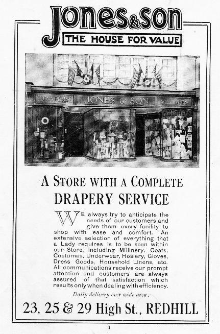
1927 advert |
 |
 |
|
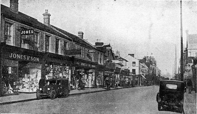
Redhill High Street showing Jones' shop 1936. |
Redevelopment swept away much of old Redhill in the 1960s. This photo from 1966 show shops, including Jones', awaiting demolition. |
 |
 |
|
|
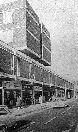
Shops such as Jones, Jennings and Liptons once stood along the west side of the High Street but by the mid-late 60s the old buildings they occupied had been replaced with the unforgiving rectangular lines of new retail and office development. Then, in the eighties, the Belfry shopping mall was built; its front entrance inserted into the 1960 building (the picture on the left is looking in the opposite direction to those above). Note that at this time the old High Street still existed to this point; it was covered by an extension to the pedestrianised area a few years after. The main body of the mall reached back to fill the space bounded by Cromwell Road, Matthews Street (part of the new one-way system running past the George and Dragon) and Station Road West. |
||
 |
 |
|
|
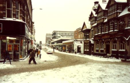
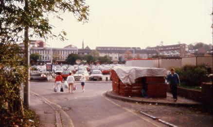
A snowy view south down the High Street from the centre of the town on the 14th January 1987. The Belfry had not yet been built. |
Woolworths being extended into the gap where Rees Road once met the High Street |
|
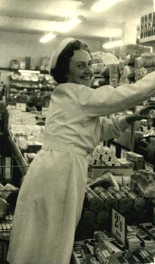
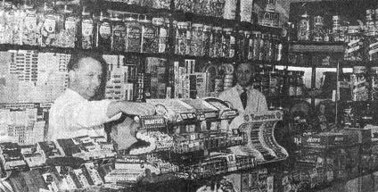
While on the subject of
Woolworths here's a wonderful picture of the bread and
biscuit counter being rearranged in that shop in the
1960s, reminding us of the time when such things were
sold there and when staff gave a personal over the
counter service. Notice the price signs. A popular
request of the time was broken biscuits sold and weighed
loose. In the 1960s the price of a loaf was less than one
shilling. The lady in the picture is Freda Sargent, the mother of Bob Sargent who kindly supplied the photo. |
 |
 |
|
|
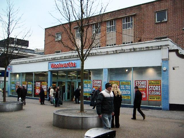
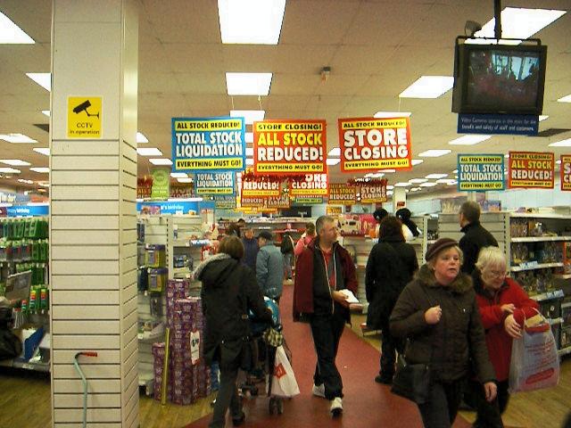
Woolworths fell victim to the recession and general trading conditions of 2008 and in the December went into administration. These pictures were taken on the 12th December 2008 the day after the SALE and STORE CLOSING signs went up inside and out. |
||
 |
 |
|
|
The picture above was taken from Rees Road (no longer in existence) and looks south to Cromwell Road across the car park that was there before the Belfry occupied much of this area. The church spire is that of the Congregational Church in Chapel Road (since demolished). The two other Belfry entrances are in Cromwell Road, about where South Road used to be, and in Station Road not far from its junction with Warwick Road. |
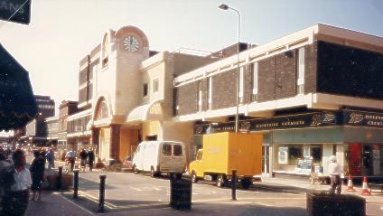
Part of the High Street today a few years after the Belfry was built and with the market in full swing. Since the trees (shown above) have been planted the market cannot be set up here and is now in London Road and Station Road. |
|
 |
 |
|
|
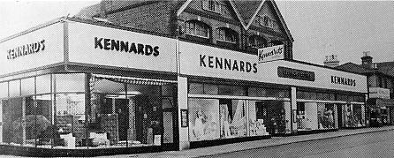
Further along the east side of the High Street, in the first half of the 20th century, was Chalmers building, with the twin gables, and Chandler's fruit, veg, poultry, fish and butchers shop, seen on the right of the above picture with the barrow outside. This shop was next to the alley to the railway station, and beyond was a sweet shop, Wrights the boot repairers and Quintons sports shop. |
After the 2nd World War these builds fell vacant and were combined into Kennards department store. |
|
 |
 |
|
|
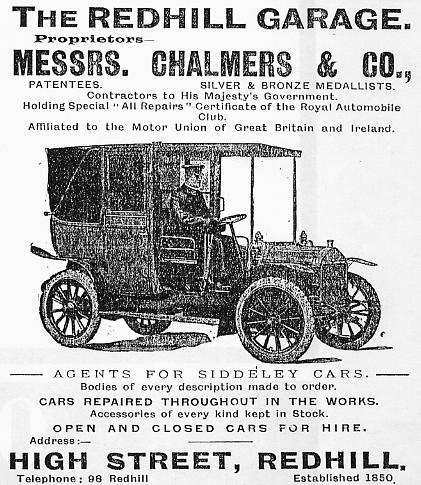
This Chalmers advert from 1909 states that the company was established in 1850 |
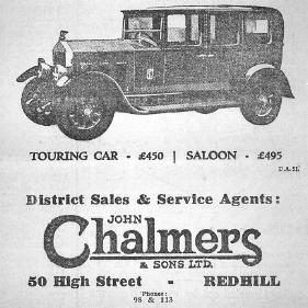
A Chalmers advert from May 1928 for the Wolseley 6 |
|
 |
 |
|
|
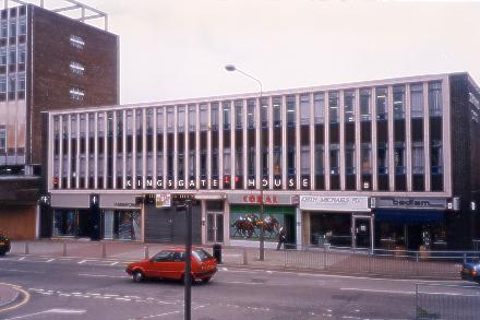
Here's what replaced the buildings on the east side of this part of the High Street. The taller of the two buildings, Brabazon House, has itself recently been rebuilt. The smaller building, Kingsgate House, stands about where the old Green CLB hut used to be |
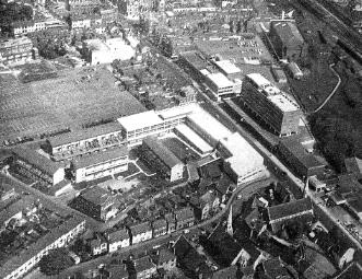
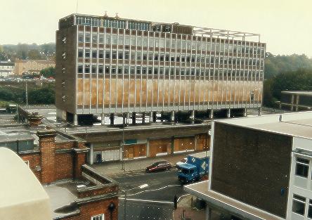
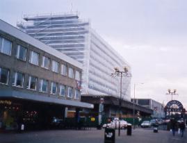
In this aerial view of Redhill the High Street before the one-way system was completed runs from the top of the picture to the bottom right. The large bulding half way along on the right is the CAA building, Brabazon House. Behind it is the old Odeon cinema |
|
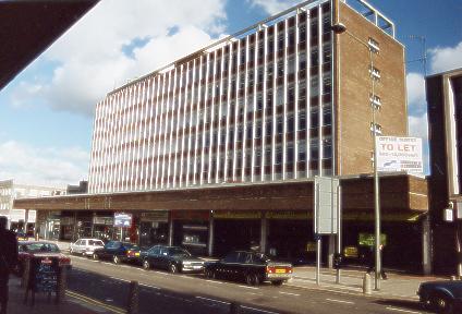
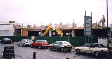
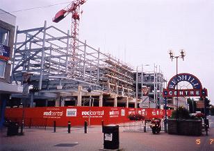
In 1997 Brabazon House was made ready for rebuilding, with the shops below closed and its offices empty. For some time it was wrapped in plasting sheeting while demolition took place. The ground storey structure was kept and the new building was built on top.The new Brabazon House (renamed called Redhill Central for some reason) once again towers above buildings either side |
 |
 |
 |
 |
 |
|
|
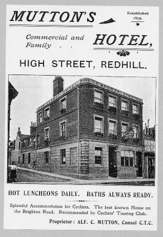
Returning back in time, and further along on the west side of this part of the High Street was the Temperance Hotel, then Grove Road, then the Royal Oak pub (out of view in this picture as it was set back from the road - a picture of the Royal Oak appears on the 'pubs' page of this website), Lower Bridge Road and the Pavilion Cinema. Then came Chapel Road. The Pavilion later became the Rio. It suffered a fire and stood empty for several years in the 1950s before it was demolished. Facing the cinema was St Matthew's Rooms. |
An advert for Alf Mutton's Temperance Hotel from the 1890s |
|
|
An account from the Surrey Walking Club's Magazine of the late 1890s tells of a walk done by members from the Swan and Sugar Loaf pub at Croydon to Westminster Bridge, then to Brighton and then back to Croydon. On the final leg they stopped at Mutton's Hotel in Redhill for soup followed by a rub down and a drink of Bass ale. On account of Alf Mutton's hotel's Temperance status it was pointed out that the ale was served from a trap outside. |
||
 |
 |
|
|
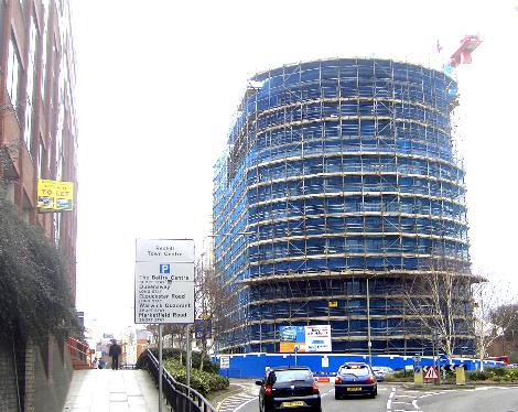
Kingsgate House was built next to Brabazon House on the site of St Matthew's Rooms. It was demolished in March 2007 and a new building has now replaced it. |
The building replacing it is shown here under construction in 2008. It towers 15 floors over the old 3-4 floors of Kingsgate house |
|
 |
 |
|
|
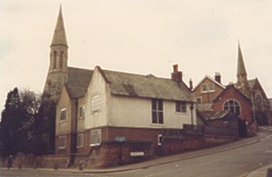
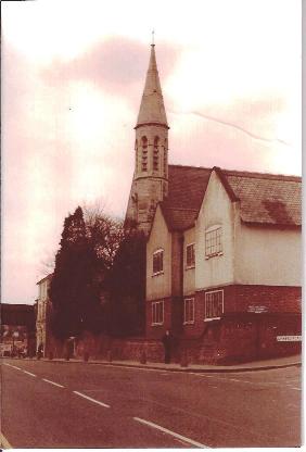
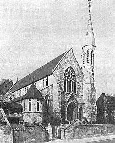
Chapel Road, seen here, had the Catholic church of St Joseph's adjacent to it. This view of St Joseph's Church, Presbytery and School with the Congregational Church at the top of the hill of Chapel Road cannot be seen now as all are now gone, replaced by Bridge House on the High Street and flats where the Congregational Church and Hall stood. |
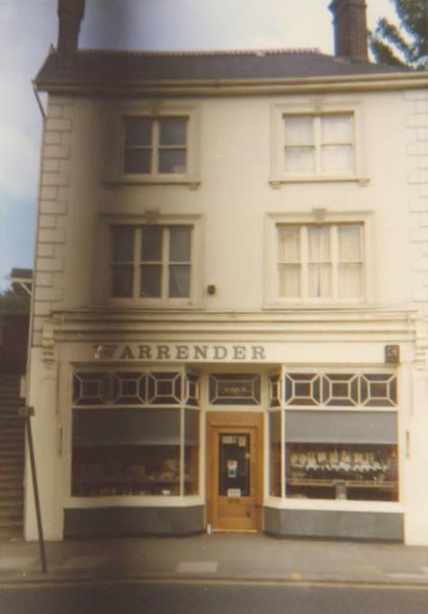
St Joseph's Church and
presbytery with Warrender's shop and the Reading Arch
beyond. (Photo courtesy Jane Smith) |
|
 |
 |
|
|
St Joseph's Church |
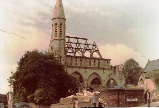
St Joseph's in process of
demolition (Photo courtesy Jane Smith) |
|
 |
 |
|
|
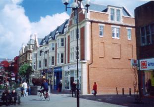
Here's what replaced all the buildings from Cromwell Road (car and van turning into it) and Reading Arch. Bridge House (the far redbrick building) stands where St Joseph's Church and Warrenders were. The row of offices and shops fills the space between Chapel Road is between it and Cromwell Road. Neither Lower Bridge Road nor Grove Road reach a junction with the High Street as they once did |
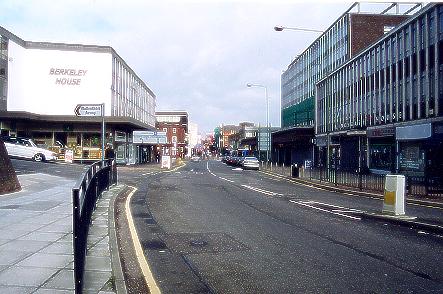
The not-so-long-ago view into Redhill from close to Reading Arch. Kingsgate House and the old Brabazon House are on the right with Chapel road and Berkeley House on the left. The redbrick Dog and Duck (old Tower) pub stands out from the other buildings halfway down on the left. The red of the Harlequin complex can also been seen in the far distance just across the town centre. |
|
 |
 |
|
|
Warrender's Jewellers was tucked between St Joseph's Church and Reading Arch. S. Warrender & Co was established in 1947 when the Redhill shop was opened by Stanley Warrender, who was joined in Redhill by John Warrender and Frank Warrender. Warrender's Redhill closed in 1984 as part of a compulsory purchase order for redevelopment but in 1971 Frank Warrender had opened a second shop in Sutton which he still runs with his sons, Richard and Simon. (Information courtesy Richard Warrender, pictures courtesy John Eede) |
||
 |
||
|
This view is taken from even nearer the Reading Arch and includesBridge House (where St Joseph's church used to be). Notice that right of picture there's a road junction now (see next pictures) |
||
 |
 |
|
|
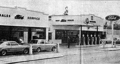
On the south east side, backing onto the railway, and filling the last space before the Reading Arch on the east side of the High Street, was RP Motors, which stood where the roundabout in the previous picture now is. RP Motors took over the Ford franchise from Chalmers' old premises mentioned earlier. It later became a Schreiber frurniture showroom when the Ford Franchise moved to new premises on the old gaswarks site the other side of the railway in Brighton Road. |
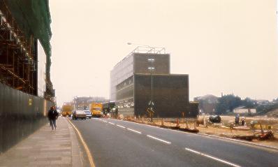
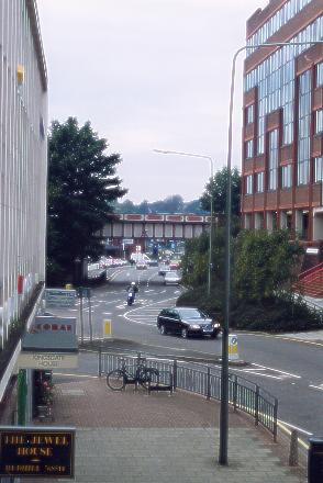
Here the RP Motors/Schreiber site is being made into a roundabout. Behind Brabazon and Kingsgate Houses is the land cleared for the new town bypass. On the left Bridge House is being built on the St Joseph's site. |
|
 |
||
|
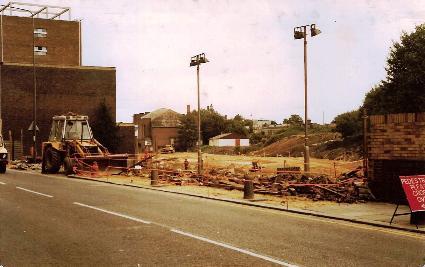
RP Motors demolished and part
of the town by-pass beeing built from Reading Arch to the
old Odeon Cinema (Photo courtesy Jane Smith) |
||
 |
 |
|
|
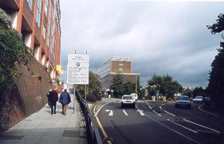
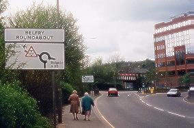
The view from the new bypass gained by cars approaching Reading Arch from the previous roundabout by the railway station. For how long 'Reading Arch' will remain a name still in common use is uncertain, for the roundabout is called the ' Belfry Roundabout' as it's floral upkeep is sponsored by the Belfry shopping mall. |
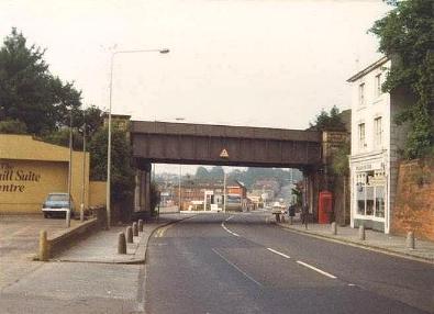
Finally, a look at the far end of the High Street and a glimpse under the bridge at Brighton Road beyond, which will have to wait to be the subject of a future page. Notice how the pavement has been raised and greenery added in comparison with picture above. |
|
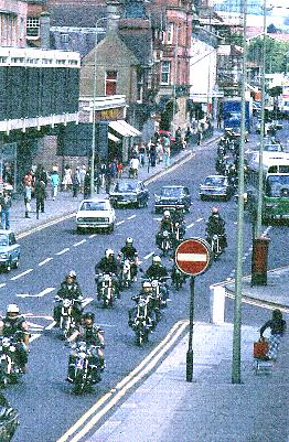
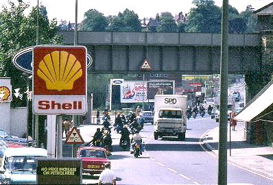 These two marvellous pictures
from 1976 were sent in by Martin Wells. They show a
funeral procession consisting of motorbikes but more than
that give us a glimpse of old Redhill. In the above
picture RP Motors premises can be seen on the left. The
wording beneath the Shell sign says
In the right hand picture the pre-pedestrianisation High Street is already part of the one-way system, with the bus stop on the right, . Woolworths hasn't been extended and the building of the Belfry hasn't begun. The pictures were taken from the car park of the old CAA building. (Many thanks to Martin for these two pictures) |
||
|
Compiled by Alan Moore from his discontinued website. Last updated 29th July 2011 |
||
 - if only the actual
price were also visible. On the right of picture is the
sunshade of Warrenders jewellers. Beyond the arch there's
a Ford sign but it doesn't look as though the garage has
yet been built.
- if only the actual
price were also visible. On the right of picture is the
sunshade of Warrenders jewellers. Beyond the arch there's
a Ford sign but it doesn't look as though the garage has
yet been built.