

Aspects of the Common
A History plus Articles on Various Aspects of the Common |
||
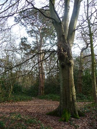
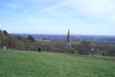
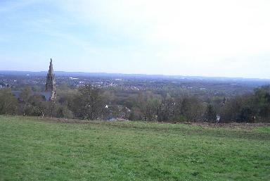
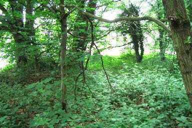
This page was partly inspired by a walk the wife and I took onto the Common after hearing that the view from the top had been restored. The top of Redhill Common has an elevation that, if unobstructed, allows a marvellous view across the Weald to the South Downs. In the Spring of 2005 Reigate and Banstead Council ended sixty years of indifference to Redhill Common by removing the growth that had provided the obstruction to the view, restoring to the local people that which was rightfully theirs. During the construction of this page I have returned many times to the common, the scene of countless hours of boyhood activity. Since 1945, when the then Reigate Council abolished the Commons Conservators, this mainly open commonland has turned into woodland. Much low growth, including bramble, has encroached upon unwooded areas and has replaced some of the grassed areas. On the banks the slippage of sand and stone has covered over an old pathway. The overall reult is a considerable reduction in the amount of commonland that is able to be used recreationally. Although this page is an observation of the deterioration of an area close to my heart it is not only that. It is also an historic account of of the common and an attempt to inform about many of its features. I have put in some 'then and now' pictures and added information about other features of the common, of which there are quite a few. I am not personally qualified to make much, if any, technical comment on the flora and fauna of Redhill Common. Perhaps information on this aspect will appear from another source. Otherwise I hope that what does appear here makes for an interesting and comprehensive page - AJM 17.4.05 |
||
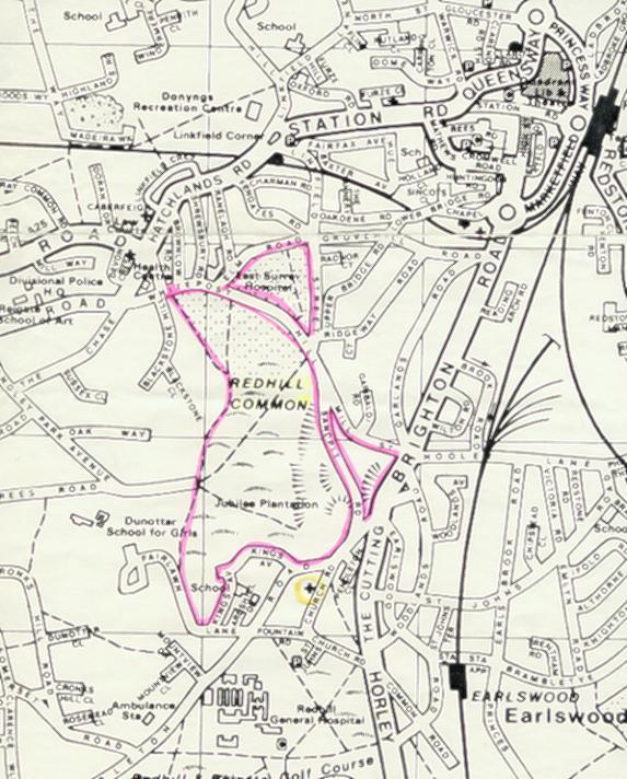
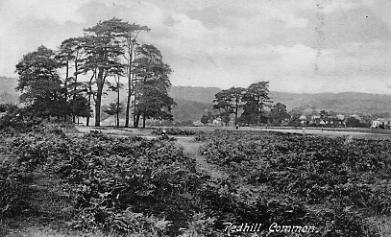
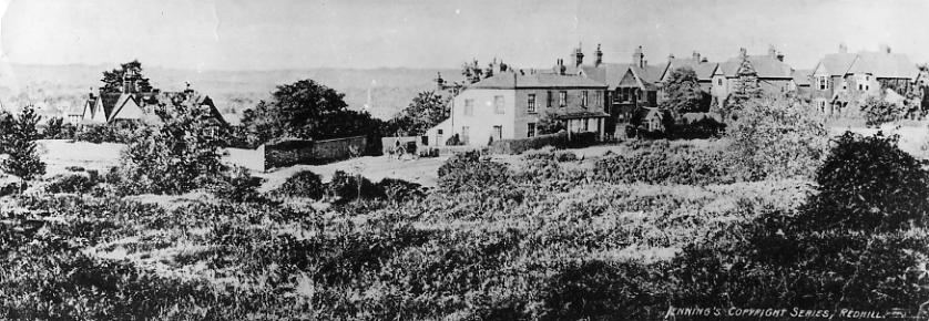
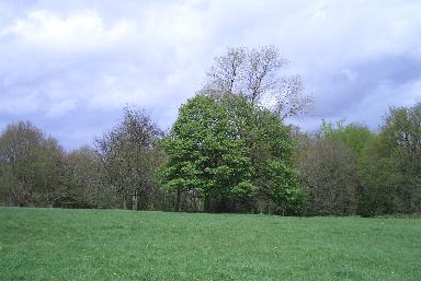
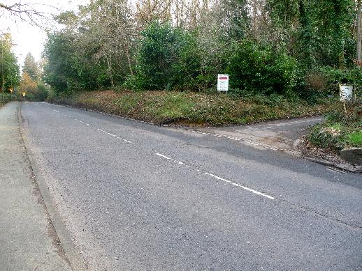
Redhill Common is here defined as that common land shown within the red lines on the map below.
|
 (HNHC)
A Brief History of the Common |
||
Medieval Times As the centuries passed more and more land was taken for agricultural use, that land remaining being generally unsuitable for the plough by virtue of position, accessibility or quality. It may be that by the time of the beginnings of the development of Reigate c1100 the boundaries of our local commons were as they are today but it is more likely that they were considerably more extensive as common land has been encroached upon during the centuries. These common lands, although grazed and considered public places, became the property of the lords of the various manors that they were in, Redhill Common being in the Manor of Reigate. The history of the evolvement of the Manor is not fully understood but medieval property organisation in SE England was of counties subdivided into Hundreds. A Hundred was a measure of land that could support one hundred households). Reigate was once a Hundred as well as a Manor. It was also a parish and the boundaries of the parish and the Manor were very similar. Reigate Manor was divided into two parts, Reigate Town itself with the rest of the Manor being known as the Foreign. The Foreign was divided into a number of other smaller manors, each of which belonged to the few large land owners in the Manor other than the lord of the Manor of Reigate itself. These were Santon and Colley, Howleigh (Hooley), Linfield and Waldehache (Woodhatch). Within these were sub-manors such as Wiggie, Flanchford, and Redstone. The population was beholden in one way or another to the Lord of the manor. Grazing rights on the common, for example, would be granted to individuals according to the amount of property or stock that they owned. Redhill Common was probably in the Manor of Linkfield, with Earlswood Common possibly in the Manor of Woodhatch. All of it was, of course, in the overall Manor of Reigate. Stories about the
Common One concerns a local glazier
who in 1593 died on the common and was buried there.
Whether it was his wish to be so placed is not recorded.
In 1697 Richard Rhodes was hanged from a tree at Reigate
home for the murder of his housekeeper. His body was hung
in chains on Redhill Common - reason unknown - but it
apparently disappeared the same night. Around one hundred
years later a skeleton believed to be that of Rhodes was
discovered on the site of Earlswood Mount. In the 19th
century another skeleton was found, this time at the foot
of the common, and with him were found a pick and shovel.
It is known that much digging for gravel was done and it
is thought that this skeleton might have belonged to a
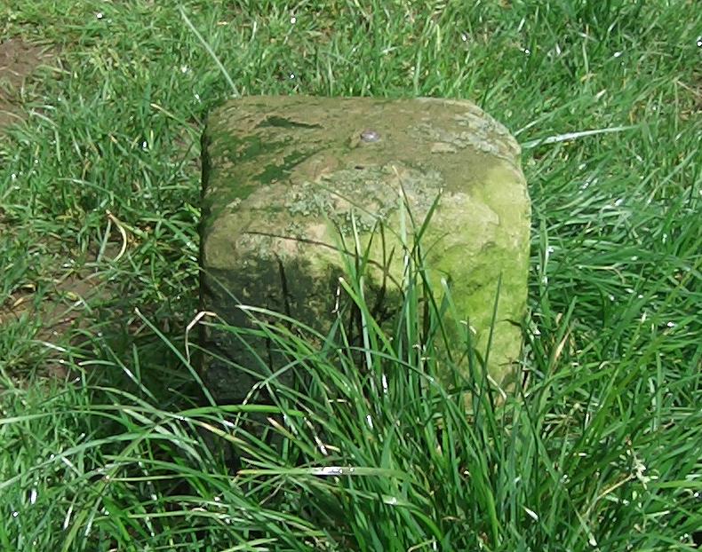
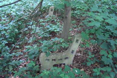
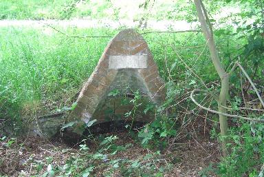
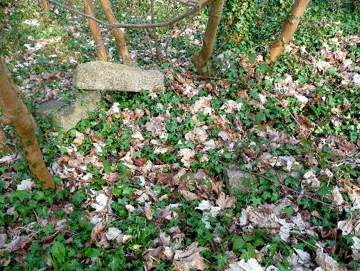
man who was buried when a trench he had dug collapsed. Site of a Prison In 1862 the Secretary for War compulsorily purchased 16 acres on the summit of Red Hill Common for a military prison. £1,000 was paid to Lord Somers, the Lord of the Manor, and £2,000 to five trustees for the persons entitled to common rights. Owing to the number and intricacy of the common rights titles, the trustees had considered the distribution of the funds in their hands to be impracticable, so none was attempted. The War office subsequently gave up the idea of erecting a military prison on the land and the Corporation opened negotiations with a view to acquiring it as a public pleasure ground, making simultaneous overtures to two parties, the Secretary of War for the purchase of the land and the trustees of the Commoners, with the aim of obtaining from them the £2,000 and using it as part payment of the purchase cost, but after protracted negotiations attempts to retrieve the money from the trustees failed through the unshakeable objection of one of these men to hand it over. |
 |
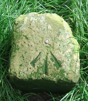 |
Marker stones define the boundary of the proposed prison. Not all survive but some can still be seen. This view of one of them shows the relative size of the stone and the war office arrow on its top. |
|
|
Common Secured In 1867 the Corporation applied
for permission to borrow £4,000 to buy the 16 acres of
the top of Red Hill Common as a means whereby 50 to 70
more acres elsewhere could be obtained for a sewerage
works. What had happened was that the best site for the
outfall for the drainage system the Corporation was
building had been identified as land at the bottom of
Earlswood Common, and the Council had accordingly applied
to Earl Somers, who was since the formation of the
Borough Council no longer Lord of the Manor but still the
owner of the common land, to grant it to them. They
conceded that the Lord had the right to the gravel but
pointed out that the commoners had equal rights to the
herbage, and queried whether the Lord had the right to
destroy one by removing the other. They began to
collect evidence and take steps towards testing the right
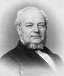
of Earl Somers to remove gravel. The parties (Barrow and
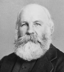
Waterlow) to pay Earl Somers £3,000 plus costs. ......... Samuel Barrow 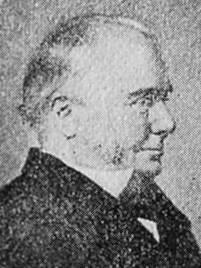 Of the £3,000 that was paid to Lord Somers £1,000 was paid by Samuel Barrow, £1,000 by Walter Waterlow and £1,000 by the Corporation. For the purposes of improvement the Corporation provided an additional £1,500 plus £150 per year for maintenance. This expenditure was a contentious issue in Council because the commons lay in the east of the Borough, so it was natural for all of the east ward Councillors to be in favour of the planned expenditure but for 11 of the 12 in the west ward to be against. The vote was enough to carry the proposal by a majority of one, however. A provisional order was prepared by the Land Commissioners for England and later embodied in a Special Act of Parliament entitled 'Commons Regulation (Redhill and Earlswood Commons) Provisional Order Confirmation Act, 1884.' Walter Blanford Waterlow |
||
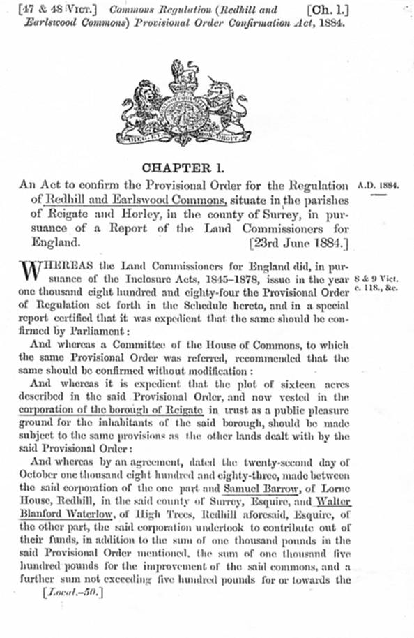 |
The first page of the Act of Parliament regarding Redhill and Earlswood Commons |
|
Conservation
T.Radford
Hope, and Messrs Smith, Austen, Pym, Brown and Summers.
The reconstruction and enrichment of the undercliff -
that part of the common most subject to the extraction of
gravel - was the subject of a number of designs sent in
after the conservators let it be known that they were
open to suggestion on the subject. Seven or eight designs
were submitted but none were considered suitable. One of
these, by Mr Richard Peat of Meadvale, was adjudged the
best. The eventual design used was one drawn up by Mr
T.R.Hooper who drew on much of the material from Mr
Peat's design, and accordingly that gentleman was awarded
the sum of 35. (The document detailing the proposed work
to be carried out on the common is set out at the end of
this page). On Earlswood Common, where the one
existing lake had been formed by clay workings, it was
decided to form a bank and create a second, upper
lake of six or seven acres. Much of this was discussed at
a meeting at Redhill's Market Hall and the meeting's
chairman, Mr Walter Blanford Waterlow, said that the
enhancement of the common by the new pond would result in
a sheet of water that could be used for boating and
skating. It is possible that some kind of water retention
was already present on part of the site of the new lake
as references at one meeting of the Conservators were
made to extra expenditure on the creation of the new pond
due to 'the clearing of mud and leaves from the upper
lake'. There was also £5 extra paid for 'the removal of
a considerable bank of black stuff, which was discovered
when the water was lowered for the other work, and which
was strongly suspected to have come from the sewage
matter of the workhouse'. (It is not certain which lake
was affected but shortly after work had started it had
been brought to the attention of the committee that
effluent from the workhouse on Earlswood Common found its
way into the lake and measures were taken to stop this).
The lower lake had always been used for swimming, not a
particularly safe pastime there, so a proper bathing area
with steps, paved bottom, diving board, fence around and
shrubs for screening, was provided. |
||
| How It Used To Be | ||||
 1 |
2 |
|||
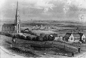
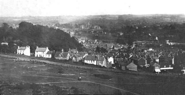
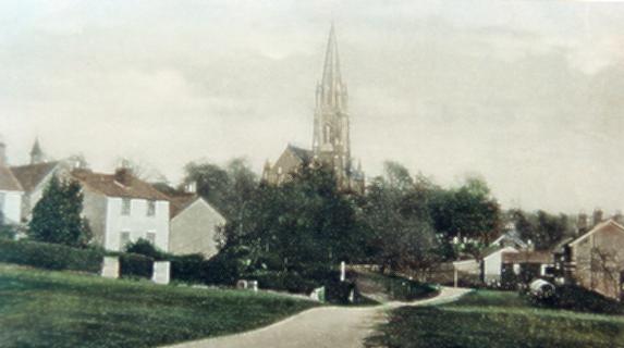
| Picture 1 on the left shows how clear the lower parts of the southern slopes of the common were in 1857. St John's Church before alterations were made to it is on the left, the Earlswood Asylum is in the middle background and the original St John's School building is on the right. Behind the school a tall-funneled steam engine on the London-Brighton line pulls carriages towards Redhill. Picture 2 on the right shows that sixty years later the lower slopes were almost completely clear of tall growth all the way to Kings Avenue. The clock tower of the newly built upper building of St John's School can be seen above trees on the other side of the road. The hollows in the foreground were possibly sites where road gravel had been dug. In the 1930s, 40s and 50s all that grew on the slopes was gorse and it was possible to toboggan from the top to the bottom of the sloping path, coming to a gentle stop against the wall of the laundry that was just beyond the school. | ||||
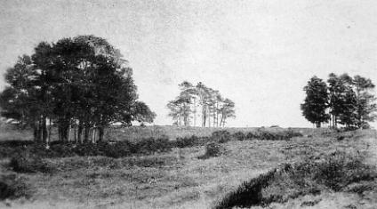
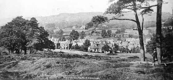
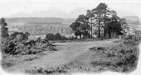
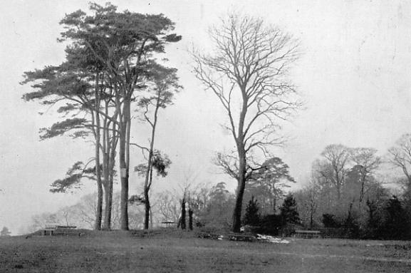
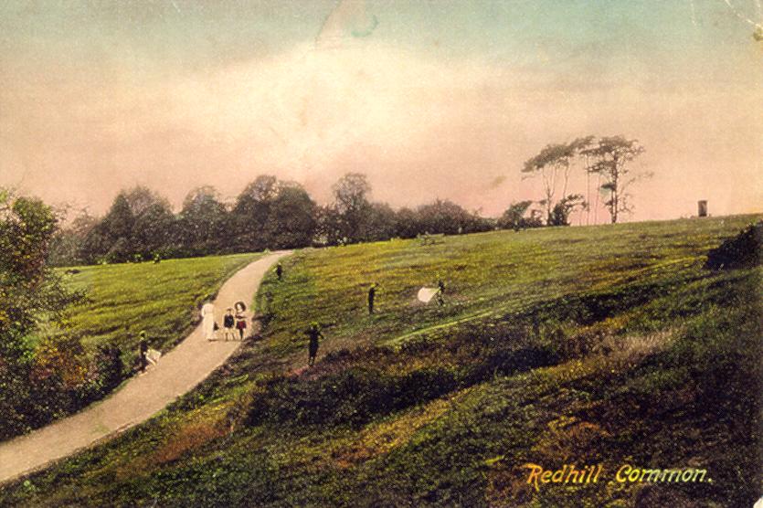
This view south from the top common, taken in 1910, shows that although there was some growth on the southern slope the view was there for all to see. |
||||
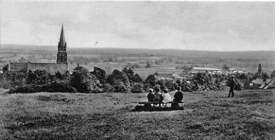
And looking in the opposite direction the openness of the common is even more obvious. This picture taken before 1919. | |||
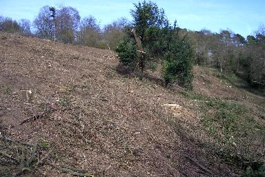
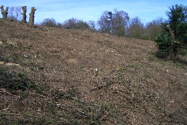
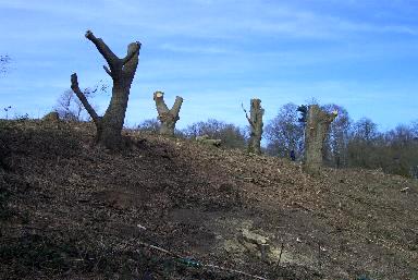
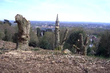
The Way it Is Now
Some clearance was carried out on the top of the common to restore the view
.JPG)
7
8
9
10
11
12
| Upon reaching the top of the path it is clear that the effect is not pretty but it is also very clear what a magnificent difference has been made. Nature will swiftly re-cover the slope with greenery. | ||
 13 13 |
 14 14 |
|
| And a few paces further on the view is fantastic, these pictures do not do it justice. | ||
 15 |
 16 16 |
 17 17 |
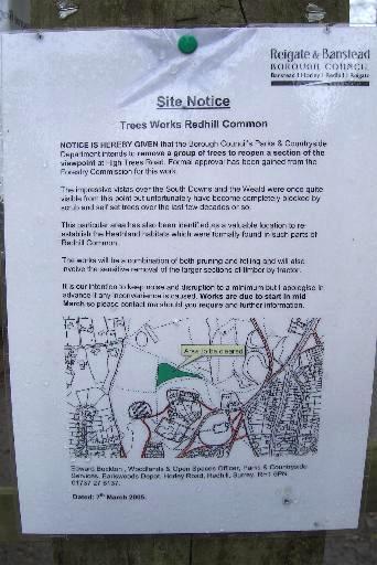
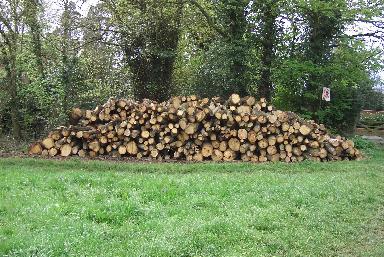
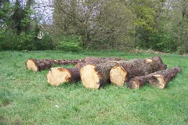
| The notice announcing the reopening of the viewpoint | Logs piled up from the clearance | Five larger logs lay separate from the others. The boundary stone pictures above can just be seen above the left hand end of the far log. |
 18 18 |
 19 19 |
|
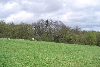
| Of course, views from other parts of the common have also been lost. On the left this view south towards the top of the common shows how open it once was; it has been totally lost. A quarter of a mile from the top common this early 1900s view north west to Elm Road, the old cottage hospital, then across the houses and fields beyond to the North Downs, has also gone as the land in the foreground has become wooded.. | ||
 20 20 |
 21 21 |
|
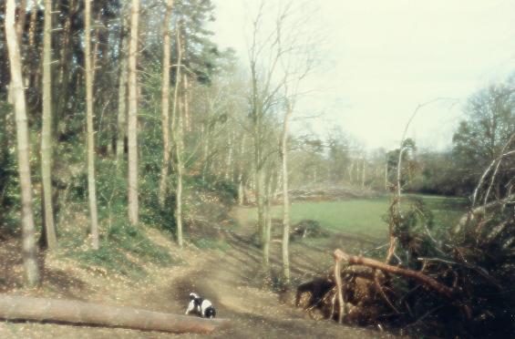
| This picture was taken in March 2009 and is of the area where the horseman in picture 5 was standing | Much of the common has been overrun by brambles | |
 22 22 |
 23 23 |
|
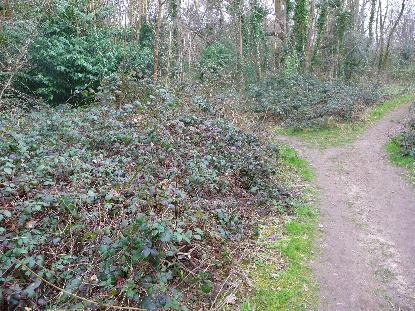
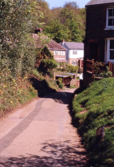
| This picture was taken on the top of the common looking north with my back to the view across the weald. In 1945 I was walking to school when a V1 Doodlebug on its way to London had its engines cut out prematurely directly above me. I watched it glide all the way to the Merstham hills where it exploded. Since then the trees have grown up and the hills cannot be seen. | The horseman in picture 5 is between two tracks that go up to the top common from the path up from the junction of Whitepost Hill and Mill Street. This picture was taken from the top of that path. The track nearest the camera in picture 5 is as it used to be, straight and 5-8' wide (see picture 24). Now it weaves through the woods and is only 3' wide at its widest points. | |
 24 24 |
 25 |
|
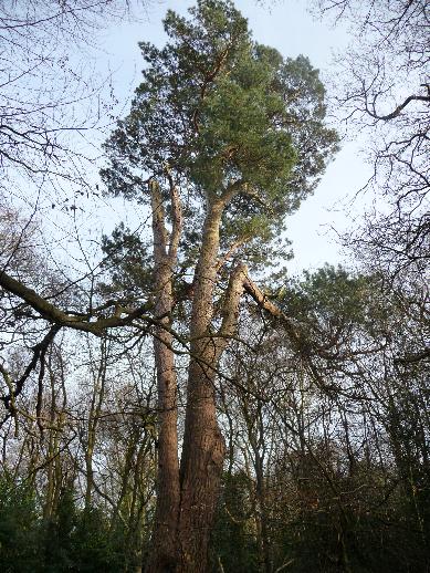
| The path referred to in picture 23 caption | North of the pond one of the pines from one of the the old clumps still stands | |
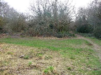
Loss of the Path at the Foot of the BanksThe top lawn has changed dramatically. Erosion of the bank has resulted in the old path that ran along its foot being covered with sand which then became colonised by bramble and other growth. The result is that the footpath now goes across the centre of a lawn that was once used for school sports and many other activities. |
||
 |
 |
|
| 1980s picture taken to show fallen trees but the original path is clear to see. (picture courtesy HNHC) | This picture from 1987 also shows fallen trees and the original path (HNHC) | |
 |
 |
|
| 2005 - Scrubby growth covers the old path. | 2005 - Path now crosses the centre of the lawn | |
 |
 |
|
| The reason for the change is that the banks, once almost too steep to climb, have slipped from the top and rearranged themselves at 45 degrees, covering a large and previously falt area at the bottom. These pictures taken 1987. (HNHC) | ||
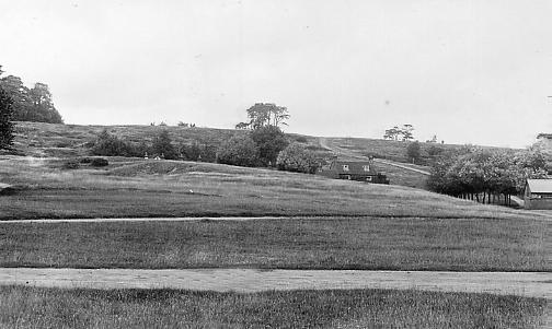
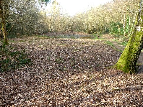
| The Once Open and Sandy Space to the South | ||
|
|||||||||
 |
|
|
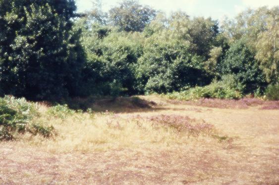
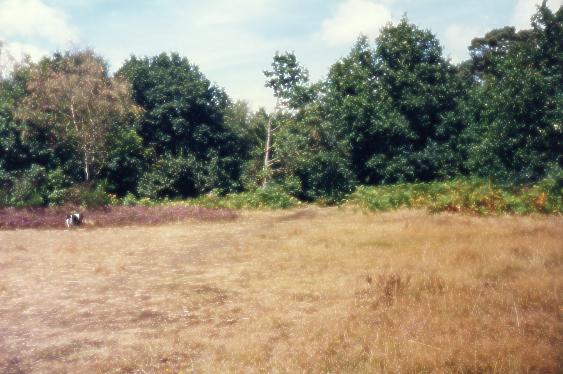
These two pictures show the area in 1987. It is clear that the surrounding area had become covered with trees and that the 1910 view had disappeared completely. The open space still existed, though, as did the heather. (HNHC) |
||
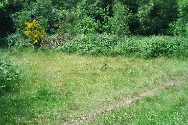 |
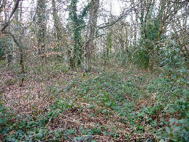
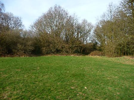
The space is now much smaller because of invading brambles and other growth, including gorse, and has also been covered by grass. Where the heather still exists it grows now in a taller, more woody form than before. The old banks at its edge are difficult to find. | |
 |
||
It was close to the open space above from where this view of houses on whitepost Hill from the southern side of the common was taken in the 1920s. The houses are still there, the view is not. On the far left is Whitepost House. On the far right are houses that stand on the east side of Upper Bridge Road. Between are houses and cottages on Whitepost Hill. One of those in the centre is where the Jupp family, featured in another page on this site, used to live. (Picture courtesy HNHC) |
||
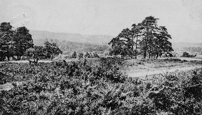
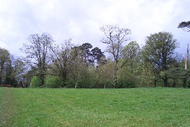
Trees on Redhill Top Common |
||
 |
 |
|
| This view east from the centre of the common shows what remains of a clump of trees planted in 1887 to commemorate Queen Victoria's golden jubilee. The trees in question are the taller ones picture centre. The memorial in view is discussed below. | This view, taken from the same
spot as the left-hand picture, looks west at what remains
of a clump of trees planted in 1897 to commemorate Queen
Victoria's Diamond Jubilee. (Picture A - see picture C below) |
|
 |
 |
|
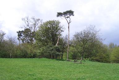
| Still looking west the lone pine stands with a few other trees inside a raised mound in circular form around them. It is reminiscent of some ancient burial mounds but is thought to be probably the result of Victorian tree planting. (Picture B - see picture C below) | Another clump towards the north west part of the top common, also in an earth circular mound, contains few if any of the trees that were ther sixty years ago. | |
 |
||
| Picture C shows the two clumps shown in A and B above together in the early 1900s. Of the four pine trees seen here only one now survives. Notice also how small the trees in the 1897 clump behind are. | ||
Apart from the two most noticable groups of
trees planted in raised rings on the top common there
were around six other such groups planted on the southern
slope of the common. One on the common's east side was
destroyed during digging operations but the others have
been identified in the past. How easy they would be to
locate now that their banks may have been eroded and
some, if not all of their trees fallen, is difficult to
say. The 1933 map reproduced above certainly shows
several other tree groupings, as do one or two of the
pictures below. |
||
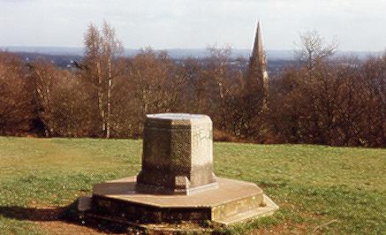
A Proposed War Memorial |
||
 | ||
|
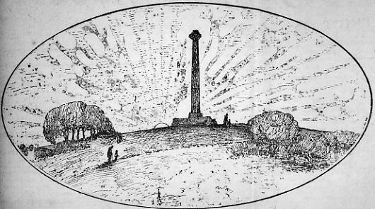
In 1919 there was a suggestion for
a war memorial in the form of a thirty-five foot high
Saxon-style cross to be erected on Redhill Common. Public
meetings at Reigate and Redhill were in agreement to this
memorial being built. The cross was to have a rough
surface and the base was to have seats facing all four
compass points and be so designed as to give shelter for
five to six persons whichever way the wind was blowing.
It would weigh 45 tons and cost approximately £1,750. |
||
|
||
|
||
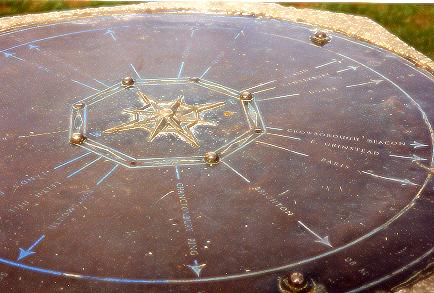
The
memorial |
||
|
||
|
||
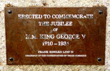
The same 1935 'Crossroads' article
went on to say 'The stone is a handsome one and no
doubt will be held in regard by residents and visitors
alike. To a degree, although not stated, it also
commemorates the long and devoted labours of the late
Alderman Lemon in preserving the amenities of the commons
and in protecting this land for public use for all time.
The question is that if Alderman Lemon was so concerned
with conservation, why did he allow an historic monument
that already commemorated the fact that Redhill was
partly founded upon the arrival of the railway, to be
destroyed? We shall never know.' |
||
Mr
Frank Lemon |
||
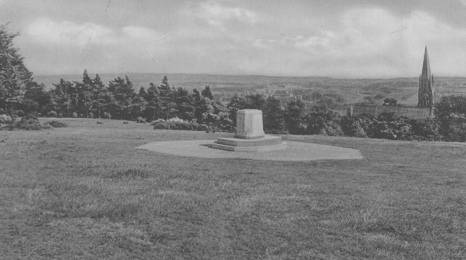
 There is an important point connected with the memorial
which ought to not passed unnoticed, and it is that it
was converted from a sighting pillar, built when the
railway first came through Redhill, and clearly seen
centre right of the adjacent picture of the common. A
'Crossroads' article in the Surrey Mirror made reference
to 'the pile of brickwork that the stone now
replaces', and said that not long before Alderman
Lemon passed away he was recalling to a few friends the
reason for its original erection. That reason was to plot
in 1841 the route of the long straight of the Tonbridge
line from the Philanthropic bend to the Ashford tunnel,
and the article said that the sighting pillar should have
been preserved at all costs, not sacrificed to a memorial
that could have been erected elsewhere.
There is an important point connected with the memorial
which ought to not passed unnoticed, and it is that it
was converted from a sighting pillar, built when the
railway first came through Redhill, and clearly seen
centre right of the adjacent picture of the common. A
'Crossroads' article in the Surrey Mirror made reference
to 'the pile of brickwork that the stone now
replaces', and said that not long before Alderman
Lemon passed away he was recalling to a few friends the
reason for its original erection. That reason was to plot
in 1841 the route of the long straight of the Tonbridge
line from the Philanthropic bend to the Ashford tunnel,
and the article said that the sighting pillar should have
been preserved at all costs, not sacrificed to a memorial
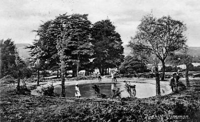
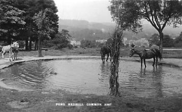
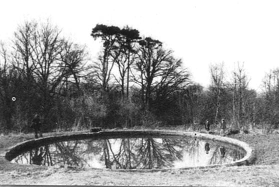
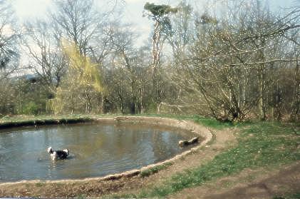
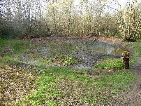
that could have been erected elsewhere. | The Pond on Redhill Common | ||
|
||
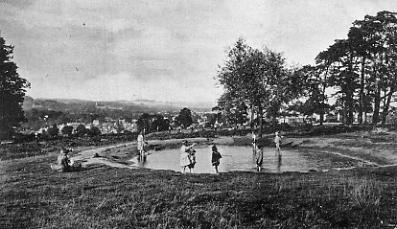 |
 |
|
| The pond on Redhill Common in 1905 | The pond on Redhill Common in 1910 | |
 |
 |
|
| The pond on Redhill Common in 1915 | The pond in the 1950s showing increased growth around it | |
 |
||
| The pond in 1987, still retaining its '50s characteristics, although surrounding growth has intensified. (HNHC) | The pond being worked on by preservationists in the early 1990s (HNHC) | |
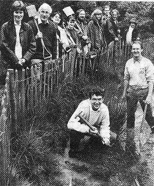 |
 |
|
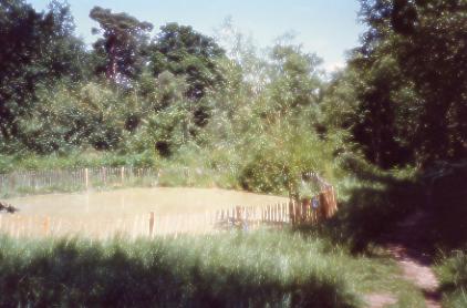
| Reigate Area Conservation Volunteers worked on the pond during National Environment Week in summer 1994 | The pond on Redhill Common in 1995 |
 |
 |
|
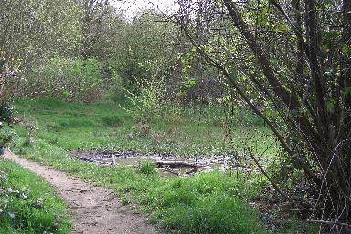
| The pond on Redhill Common in May 2005 - a mere puddle | The pond on Redhill Common in June 2005 - completely dry | |
As can be seen from the above pictures the pond is not what it was. Once set in the open it has been allowed to become the victim of encroaching vegetation. In the 1990s restoration work was carried out and the pond fenced but since then it has suffered badly. The fence soon became broken down and the pond suffered the consequences of being choked by leaves and other debris. Now, with a six-foot tree already well established in it, it is slowly ceasing to be a pond at all. Much of the nearby natural drainage misses the pond altogether. If left as it is it will take just a few years more for it to be just a memory. Fortunately there are plans which, if brought to fruition, will restore it. |
||
 |
 |
|
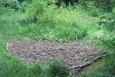
| Walking down to the pond in March 2009 it can be seen that a large area south of it has been cleared | The pond in March 2009 | |
The Pleasure Grounds at Mill Street |
|
 |
 |
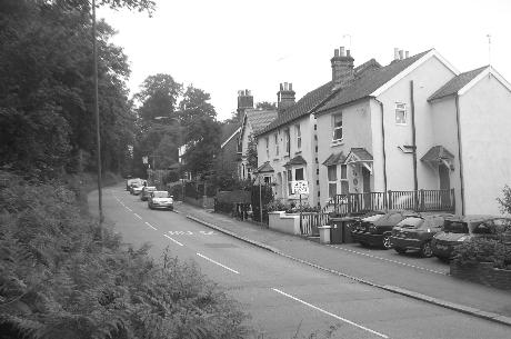
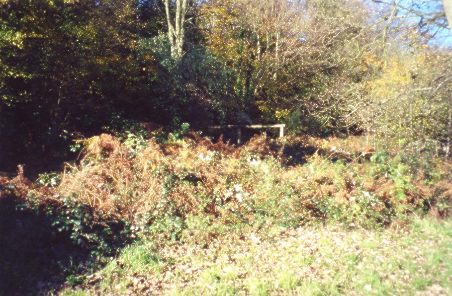
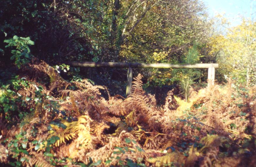
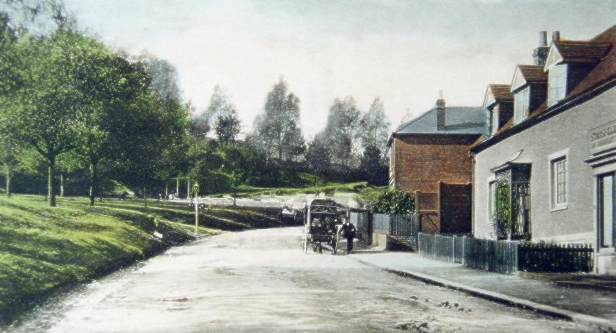 This 1910 postcard of Mill Street also shows a part of 'the pleasure grounds' . The whole of the left side of the picture shows open common, halfway along which swings can be seen. The pictures below, taken in 2000, show how overgrown the part of the area where the swings once stood has become. The frame still stands (either the original or a replacement on the same spot) but the swings are long gone. |
 |
 |
Other Structures on the CommonIt is surprising how many man-made structures there are on the common, some small some very large. Already mentioned in detail above are the prison marker stones, the George V monument and the pond, which once had a brick wall around it. Others are discussed below. |
||
A Forlorn, Abandoned and Once Accessible Seat |
||
 |
 |
|
| Another example of how the common has deteriorated. This the remains of this seat stand close to the old East Surrey Hospital on Whitepost Hill. Cross the road from the hospital, approach the seat across an open grassed area and there was a few moments peace away from the hustle and bustle of the world. But trees have grown and matured around it, their canopy blotting out the sunlight. The grass has died, bramble and other ground covering plants have taken its place; there is even a twelve-foot tree growing where its seat once was. It is a rather sad testament to how the common once was and how parts of it that were once usable are that way no longer. | This is the area where the seat stands. The sturdy sapling in the left foreground is the one growing through the seat, the righthand support for which can just be seen sticking up through the low growth about a quarter of the picture in from the tree on the right. The picture was taken at too bright a setting to enable the background to be visible, but where the light shines in through the trees is the edge of the common as it borders on Whitepost Hill. | |
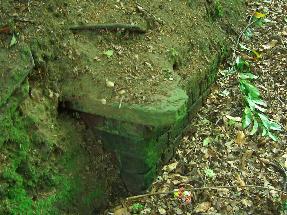
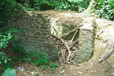
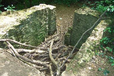
Unknown structure |
||
 |
 |
|
| One about which nothing is known is the brick-built box-like structure on the left hand side halfway up the path to the common from the junction of Mill Street and Whitepost Hill. It can be seen above left and is shown close up on the right. As the bank has slowly eroded so it has become more prominent although the bank must have been dug away for it to be made, or made over it at some time. As it seems not to be accessible, and bears no signs of activity, its purpose is a mystery. There was during WW2 an oil line across the common (I believe); perhaps it was something to do with that. If anyone has information about it, or another theory as to its purpose, this author would be very interested to hear it. | ||
Old Building |
||
 |
 |
|
| The remains of this old building on a lower part of the common beneath the banks appears to be made from the carr stone that is readily available there. It could date from the days of the diggings by the Lord of the Manor; perhaps it was a tool store. It was certainly once a part of a larger structure and pre-1945 there was a wooden hut with a corrugated iron roof here that was used by the Common Keeper and his staff, | ||
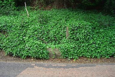
Horse Trough and (right) Tank Traps |
||
 |
 |
|
| Believe it or
not but there's a horse trough under this ivy at the top
of Mill Street. It has drinking basins on three levels -
one for dogs as well - and may have been spring fed. |
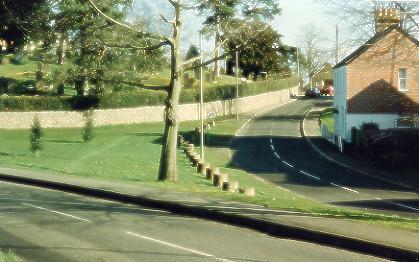
These tank traps left over from WW2 are a familiar sight alongside Fountain Road - so familiar, in fact, that it would be a shame if the were ever removed. And they should remain for their importance as a local historic reminder of times past. Probably intended for use on the A23 London to Brighton Road in case of invasion their true size cannot easily be seen as over the years they have sunk part way into the ground. | |
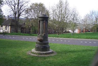
| Gedge Fountain | ||
 |
.JPG) |
|
| This fountain originally stood on the island at Shaws Corner and was moved to its present position close to the junction of Elm Road with Whitepost Hill in 1923 when the island was being prepared for the war memorial to be erected upon it. Edward Gedge was a prominent member of the St Matthew's Church congregation. He went to Switzerland in an attempt to revive failing health but, as the placque records, died there in 1897. The fountain was erected by remaining congregation members in his memory. Its top was once adorned by three lights which disappeared one night many years ago. | ||
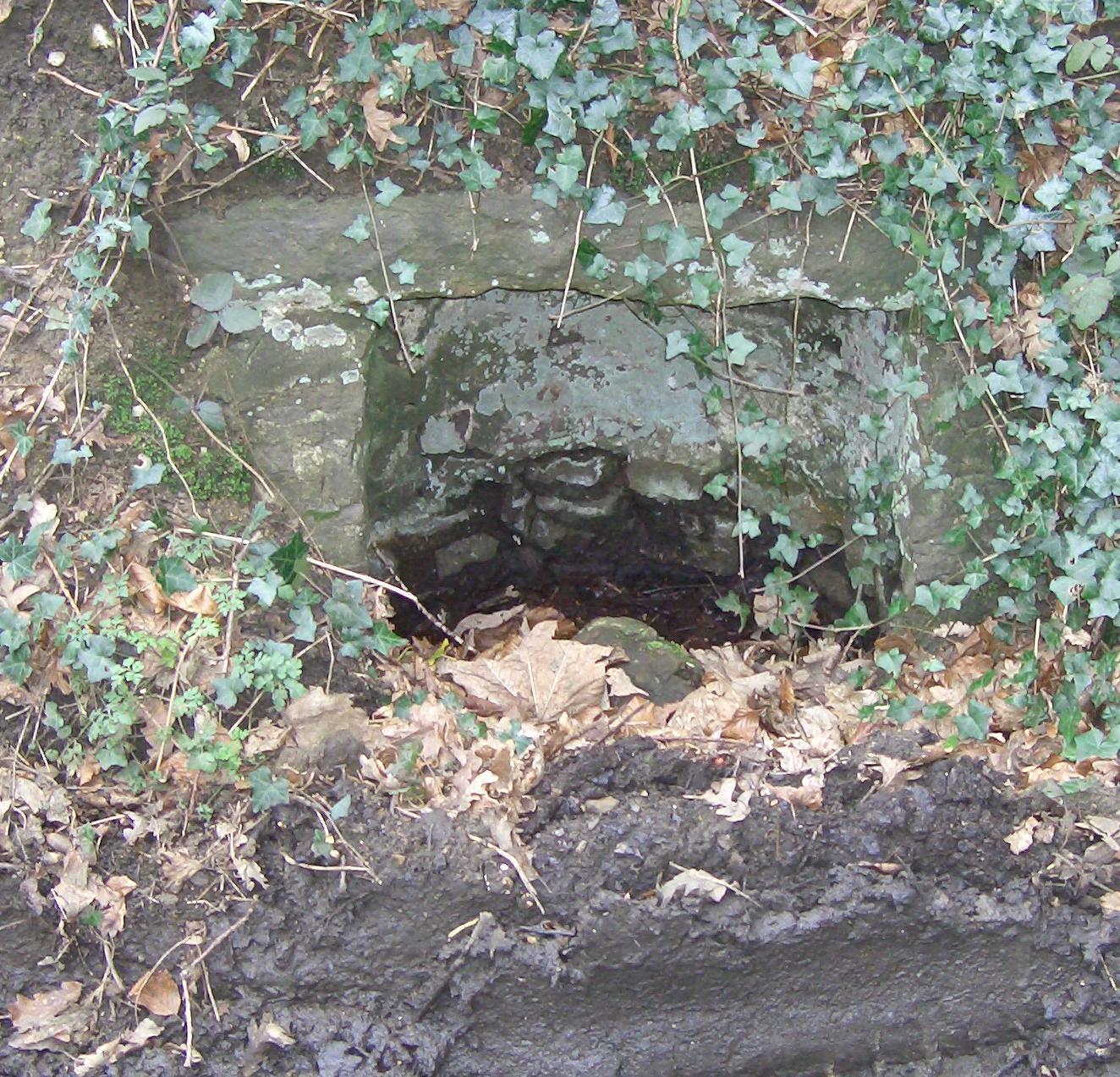
Waterslade Spring |
||
 |
 |
|
The Waterslade area was once farmland now occupied mainly by Ranelagh, Brownlow ,Shrewsbury, Charman and Fengates Roads. One of the springs that fed that farmland was this one close to the corner of Whitepost Hill and Elm Road. To have had the brick cowl built it must have once been an important and reliable source of water where animals could drink and local people could come to carry water away. The white stone set into the bricks had the words 'Waterslade Spring' inscribed on it and some of the letters are still readable. It was dug out like a well but had a lined area in front of it which must have at one time been continuously flooded. By the 1940s the frontal area was dry but the well-like part was still full and was used by people with allotments on land at the corner of Blackborough Road and the Chase (now built on). The spring is now completely dry. Following a request to do so Reigate and Banstead Council cleared the spring of encroaching growth (see right hand picture) but it is rapidly becoming overgrown once again. |
||
Whitepost Hill Spring |
||
 |
 |
|
| There is another spring halfway up Whitepost Hill. It is on the corner of the drive to Blackstone and used to be very noticable by iits leaking water accoss the road at that point. Once it was used regularly by people living in the houses close to the top of Whitepost Hill and Linkfield Street. As can be seen from the picture it once had enough importance to have its own wellhead-like structure built around it. | The spring is situated almost directly beneath the notice on the corner of Whitepost Hill and the road to Blackstone. It still weeps water onto the road. | |
Old Shelters (rendered unusable) |
||
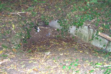 |
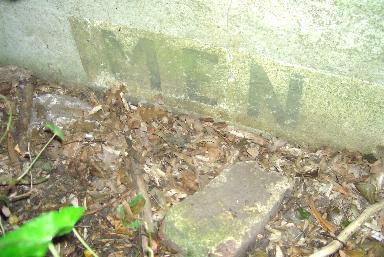 |
|
| There is a disused structure on the common that was built either as toilets or as an air raid shelter or both. Certainly it was used as a shelter during WW2 as there are still people around who remember sleeping down there in between visiting patients at the old East Surrey Hospital. The phots show the entrance to the men's side and a closeup of the word 'MEN' stencilled on the wall. The shelter may have been rendered unsable by having parts of its roof broken in. It has filled up with debris over the years. | ||
| Marker Posts | ||
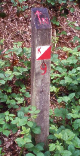 |
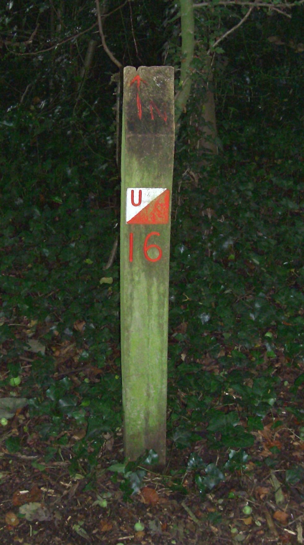 |
|
| A number of marker posts exist on the common (apparently sixteen in all); the two are shown here are numbered K9 and U16. They indicate north and are part of an orienteering course. For more information about this go to www.mvoc.org . Below is the map of the common, circles showing each of the posts. | ||
1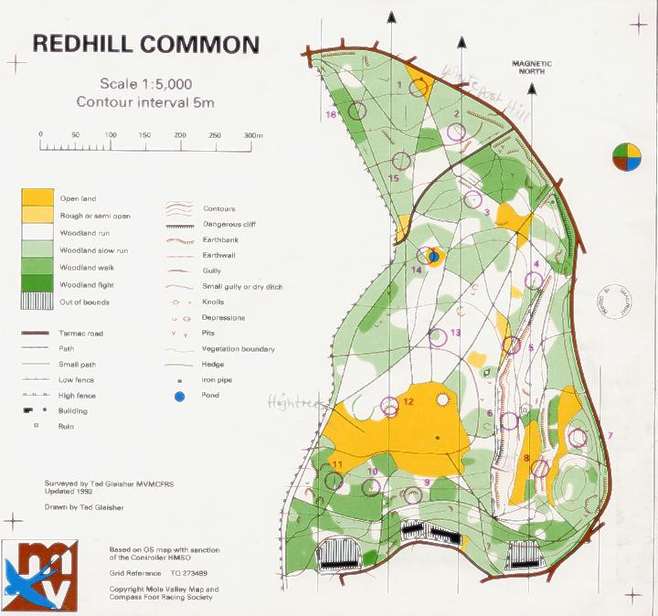 |
||
Road Material Dumps (not quite structures but worth a mention) |
||
 |
||
| There were two areas of the common used for storing road making materials. Both fell out of use in the 1960s or 70s. One is off Elm Road and this picture from March 2009 show kerb stones still laying on the site. Most are covered by ivy. | ||
Larger structures in areas enclosed by the common |
||
 |
 |
|
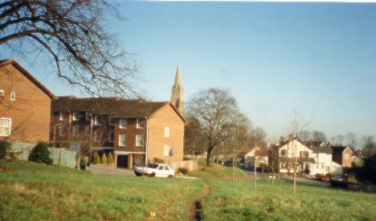
| The houses on the left are accessed from Kings Avenue and then from Ardshiel Drive and stand on land once occupied by the Redhill Hygenic Laundy. Ardshiel is an unattractive name; could it have any local significance or is simply a name inflicted by a developer? | The same view as seen left but taken before 1910 and long before Ardshiel Drive existed | |
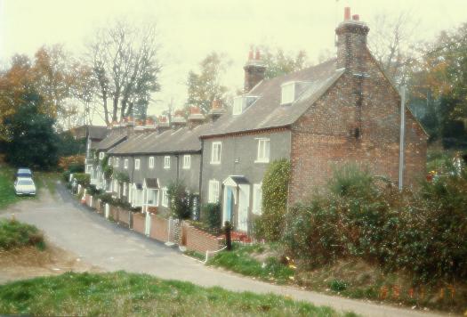 |
 |
|
| Carter's Cottages are fairly old and occupy a large part of the common. Presumably named after the builder or an early occupier. | Kings Avenue is the road that serves Fairlawn Drive, Carters Cottages and houses further along its route. | |
 |
 |
|
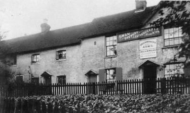
| At or close to the site of the houses seen in the previous picture was once a pub called the Brickmakers Arms. Drunken behaviour from those who frequented it led to Kings Avenue at one time being popularly known as 'Sot's Hole'. | A number of other cottages between Kings Avenue and Pendleton Road include this tucked away 16th century cottage | |
 |
 |
|
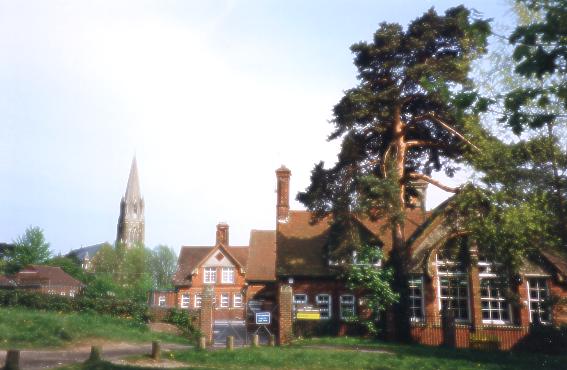
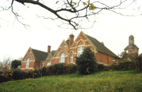
| St Johns School, which occupies two main buldings, is completely surrounded by commonland. The site was first considered for St John's Church but the ground was found to be unsuitable for burials. There is a separate page on this web site about St John's School. | ||
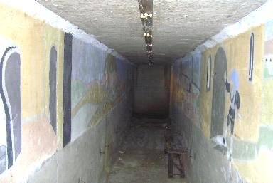
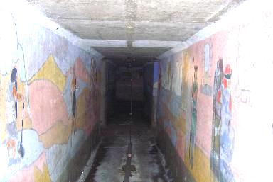
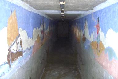
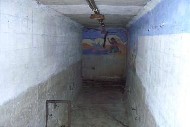
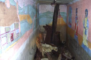
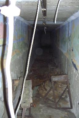
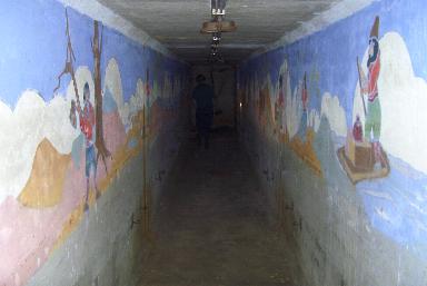
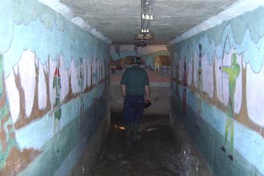
World War 2 Air Raid Shelters at St John's School |
||
|
||
 |
 |
|
| A first view of the inside of the shelter. The corridor srtretches into the distance, its walls covered with colourful paintings. Originally the shelter walls would have been lined with benches that the boys would have sat on during air raid alerts, and one of the original ones can be seen on the right. | A second corridor, where the pictures are just as bright as before. In the first corridor the old light fittings still run along the centre of the roof but here thay have fallen down and lay on the ground. | |
 |
 |
|
| A third corridor where the paintings go on and on. | A corridor where the walls are marked out in a uniform grid but where little of the surface has been covered. | |
 |
 |
|
| A dead end in the shelter that has been used to dump some of the accumulated rubbish. The pictures are still dry and bright. | Another part of the shelter. Here there was debris and detached cabling.. | |
 |
 |
|
| A scene fron Gulliver's Travels, bright and clean except for some spiders webs. | All of the paintings are on the upper parts of the walls. Here one of the original ceiling lights can be seen. | |
 |
 |
|
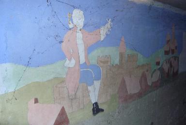
| Robinson Crusoe on the right. | Characters from Robin Hood. That's the schoolcaretaker at the end of the corridor. | |
| Mr
T.R Hooper's Document c1885 ............Below is a transcript of the handwritten document. Where I have been unable to discern the written word I have copied that word from the document as it was written. If anyone can tell me what any of the words are please contact me via the 'contact author' link aat the bottom of this page. ............I have made a few numbered remarks in notes below the text regarding some items
Arrangements having been made between Lord Somers (the
lord of the manor) and Messrs Barrow & Waterlow on
behalf of the copyholders and for securing the Common of
Redhill and Earlswood for the permanent benefit of the
residents, free from encroachment and speculation, it is
intended to apply for powers to place the content of the
said common in the hands of conservators according to the
Commons Preservation Act. The Great Sandpit I estimate the cost of
these works approximately as following: - The Lower Sandpit Upper Part of Redhill
Common Earlswood Common Besides the various proposed
works described above a sum of £50 should be provided
for such items as notice boards; posts, etc. |
||||||||||||||||||||||||||||||||||||||||||||||
 (overgrown?) on No.2
plan by removing sand from high level to low level until
the latter is raised to same height. This
will necessitate delivering about 14,000 cubic yards, and
preparing a surface of 12,400 superficial yards and
sowing grass seed. In order to procure vegetable mould to
spread over the site (in preference to the natural
(overgrown?) on No.2
plan by removing sand from high level to low level until
the latter is raised to same height. This
will necessitate delivering about 14,000 cubic yards, and
preparing a surface of 12,400 superficial yards and
sowing grass seed. In order to procure vegetable mould to
spread over the site (in preference to the natural  (screed?) I
propose to offer 1,000 cubic yards of sand in exchange
for a like quantity of loamy earth. This would be a ready
& inexspensive method of forwarding the
work. (note 2)
(screed?) I
propose to offer 1,000 cubic yards of sand in exchange
for a like quantity of loamy earth. This would be a ready
& inexspensive method of forwarding the
work. (note 2) (north?)
side next hedge of parsonage. Cut off and dispose of
sufficient sand, say 500 yards, to lean slope enough for
growth of present top soil when replaced. Repeat same
process round NW corner.
(north?)
side next hedge of parsonage. Cut off and dispose of
sufficient sand, say 500 yards, to lean slope enough for
growth of present top soil when replaced. Repeat same
process round NW corner.Summary
of Cost
|
In
view of the appointment of a Common Keeper a residence
would be required which should be on or facing the
Common. A building of the ‘Chalet’ type would
harmonize with the surroundings and might be so planned
as to afford accommodation for parties as at the
‘Swiss cottage’, Box Hill. With a view to lessen the cost of the worked Great Pit I would suffer that arrangements be made for disposing of about 2000 yards of surplus sand as remained during excavation. End of Specifications |
||||||||||||||||||||||||
Notes to the above 1) Whereabouts of drawings unknown 2) It seems that the site was more like a quarry than I had previously thought, being dug down into the gound as well as advancing westwards arcross the common. 3) There was at one time a canon placed at the top of the banks. The reason for its placement, where it came from and any other significance it may have had is unknown. Clearly it was not regarded as or tremendous importance because as the diggings progressed it fell into the quarry and was presumably subsequently disposed of. Which of the level greens is known as Canon Green is not known but was possibly the top one. 4) Without the drawings the proposed site of the zigzag path is unknown. 5) Position of these fences at first assumed to be along the top edge of the banks but if so they would not need a stile in either of them. 6) Sandpit Lane? 7) Unless Sandpit Lane is hereby referred to no other ancient road is known 8) By the look of the common no filling in was done. 9) The view was intended to be preserved from the beginning. Those criticising the recent work to restore should note this point. 10) The goods station was where the Hockley trading estate in Hooley Lane now is. The green situated on the corner of Hooley Lane and the Brighton Road was obviously a storage place for excavated materials in transit. |
|||||||||||||||||||||||||
| Acknowledgements: Thank to Chris Morley who interpreted some of the unknown words in the specification above and made suggestions for others, | |
| Finally | |
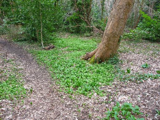 |
Wid Garlic seen growing on Redhill Common in March 2009 |
| ____________________________________________________ The above are some of the features of Redhill Common. |