

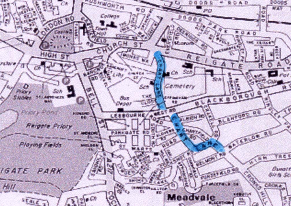
A Journey Through Reigate Past – Chart Lane
As we travel eastwards out of Reigate Church Street becomes Reigate Road at its junctions with Croydon Road and Monks Walk. Chart Lane is a turning off to the right and is marked in blue on the map. Its southern part meets West Road then continues south as far as High Trees Road where it continues as Cronks Hill.
 |
||
 |
 |
|
|
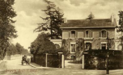
The house that was once occupied by the headmaster of the Reigate Grammar School stands on the corner between Reigate Road and the north end of Chart Lane. |
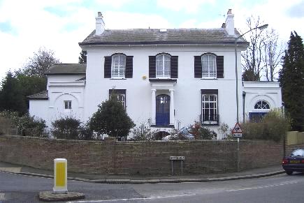
The same house pictured in March 2005 |
|
 |
 |
|
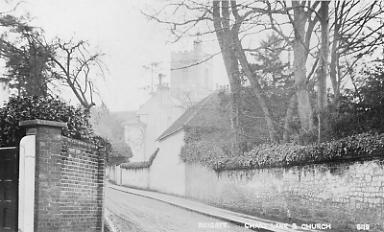
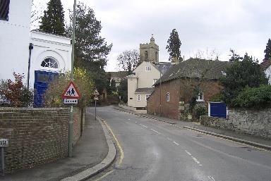
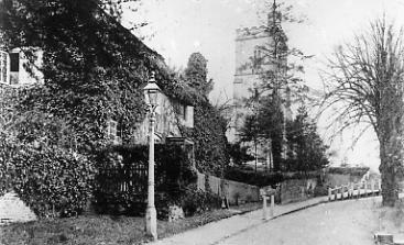
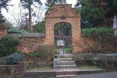
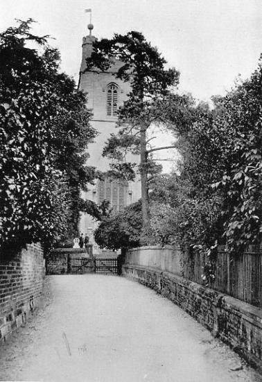
his postcard does not show the junction of Chart Lane with nearby Reigate Road but does show an unbroken wall on its west side. |
Today the wall is broken at Cherchfelle to give access to its rear yard and below the red brick building that once may have been stables and has gained some windows for access to a house. |
|
 |
 |
|
|
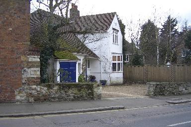
The house inserted in ground behind the old wall shown above |
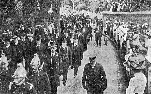
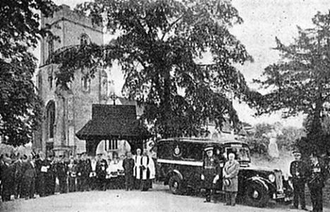
The Mayor of Reigate, Thomas Gregory, and Corporation in procession in Chart Lane on their way to church for a funeral service for King Edward VII in May 1910 |
|
 |
||
|
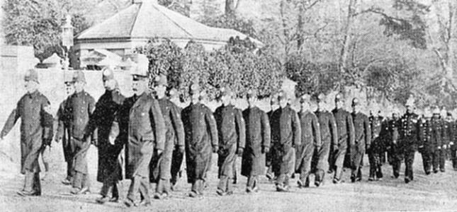
Reigate police on the way to church in December 1909 on the occasion of the visit to St Mary's Church of the Mayaor and Corporation. The officer at the head of the column is Chief Constable Mr J.Metcalfe. Behind march the combined Reigate and Redhill fire brigades. |
||
 |
 |
|
|
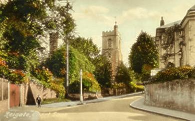
A short way up Chart Lane is the Reigate Parish Church, St Mary Magdeline. The approach to St Mary's Church was once the site of the cottage seen here on the left. On its back the picture is described as 'Colonel Packovf's (?) Girls' Charity Home c1880. Unfortunately neither the 1888 nor the 1898 street directory list it so perhaps it was defunct by that date, although this is not an infallible guide as the 1898 directory also does not mention St Mary's Church (seen above beyond the cottage) and that has been there since the 11th century. |
This card was postally used in 1922 and shows the cottage still there, although clearly no longer in use as it is almost completely covered with vegetation. The building on the right is the house called Cherchfelle, which was for a while the Reigate police station. In the days when the warning pips were broadcast to all police stations from the Fylingdales nuclear attack early warning station they could be heard on the speaker on the sill of the window adjacent to the right hand pavement. |
|
 |
||
|
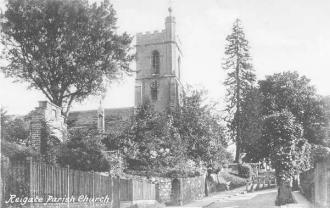
The old cottage site is now an area containing a war memorial for the Grammar School |
||
 |
 |
|
|
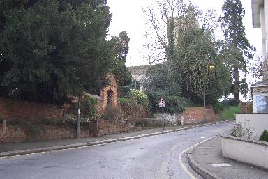
These two pictures taken March 2005 |
||
 |
 |
|
|
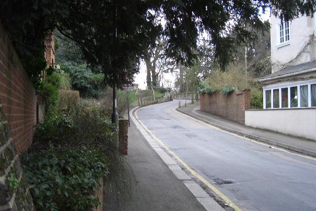
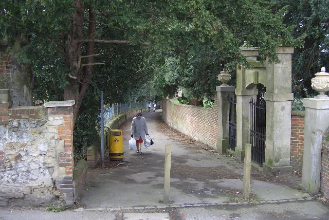
Where the road bends past the church it is too narrow for vehicles to pass. This view from the north side. |
Seen here from the south side the road squeezes between attractive old walls and even the pavement is very narrow. |
|
 |
 |
||
|
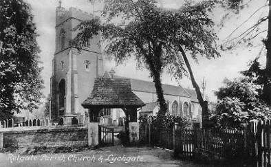
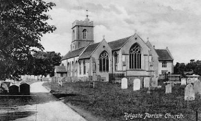
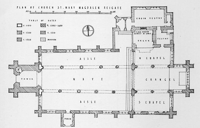
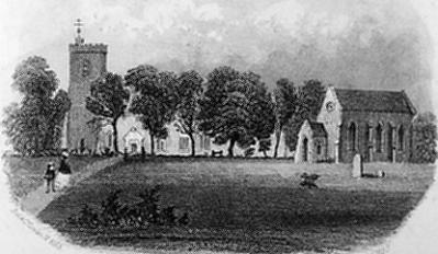
A number of postcards from the early 190%s show views of St Mary's Church. It is not mentioned in the Domesday book but it is thought that a church existed on the site from before the Conquest. Mention of it is first made in old records in the 12th century. Like many churches considerable changes have been made over the centuries but the church probably came to its present general form in the 1600s, although other alterations have been made since then. |
|||
 |
 |
||
|
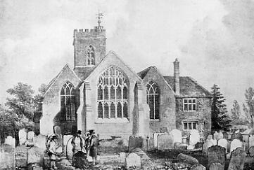
This picture, not a postcard, dates from 1833 and shows that some changes were subsequently made. |
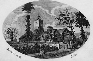
This postcard would seem to be showing an even earlier view. |
||
 |
|||
|
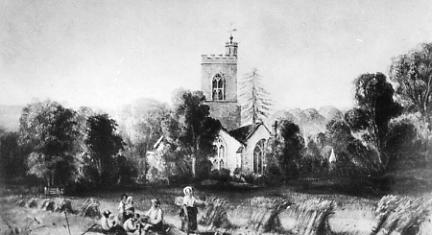
A view of the church and a nearby field with the harvest in progress |
|||
 |
 |
||
|
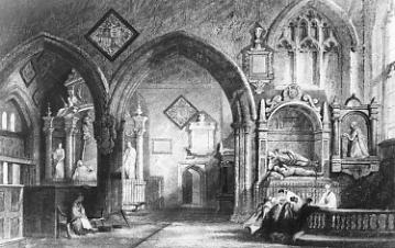
St Mary's Church interior, chancel end, 1844 |
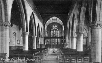
St Mary's Church interior from a postcard used in 1907, although the picture was taken in 1886. |
||
 |
|||
 |
 |
||
|
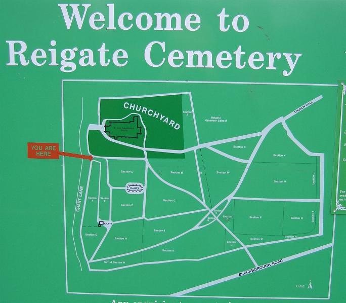
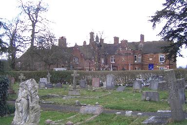
St Mary's Church south side pictured March 2005. The monument is in the graveyard around the church which is separate from the cemetery which is run by the local council (see map below). |
In the upper vestry is the parish library founded in 1701 by the then vicar, Andrew Cranston. Over 2,000 volumes are housed here, mainly thological but including an Elizabethan prayer book believed to haver been the property of Lord William Howard. |
||
 |
 |
||
|
Extra land was purchased by a Burial Board in 1855 to add a cemetery to the churchyard to meet the needs of the growing population. A similar exercise was carried out in Redhill but as no land was available at St John's the cemetery was made at Redstone in 1932. |
In this 1860 picture of the cemetery it can be seen that it was still then very much unused. |
||
 |
 |
 |
|
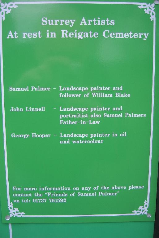
| The
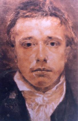
artists at rest in Reigate Cemetery: - Top Left - Samuel Palmer Top right - John Linnell Bottom right - George Hooper |
 |
||
|
A board lists the local artists, Samuel Palmer, John Linnell and George Hooper who are buried buried in the cemetery. |
|||
This new ambulance was taken over by the Reigate Corps of the St John Ambulance in June 1938 in the days when things were not done by halves. parade for which the Hastings St John Ambulance
Division band provided the music preceded a dedication
ceremony at Reigate Parish Church in Chart Lane. This major event was the culmination of a period during which St John Brigade funds had grown to the point where the Corps could afford to entirely finance the ambulance purchase. It was the third ambulance taken over by the Corps, the first two having been paid for by Sir Jeremiah Colman. The vehicle, described as the last word in efficiency and comfort for the patient, was a 1938 model Austin. |
||
 |
 |
|
|
St Mary's Church viewed across Chart Lane from St Mary's Walk |
St Mary's walk leads to Church Street in the town and is seen here from the steps leading up to the church |
|
 |
 |
|
|
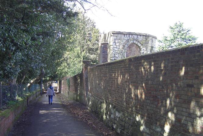
A short way down is a folly just the other side of the south wall of Chercehefelle. |
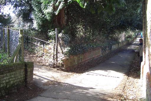
A little further along St Mary's Walk another path turns left past playing fields to Lesbourne Road by the old bus garage. This path and the fields will be pictured on the page for Lesbourne Road. |
|
 |
 |
|
|
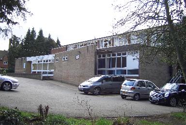
On the south side of St Mary's walk is the church hall . . . . |
. . . . . and next to that, here viewed across the cemetery, is St Mary's Preparatory School. |
|
 |
 |
|
|
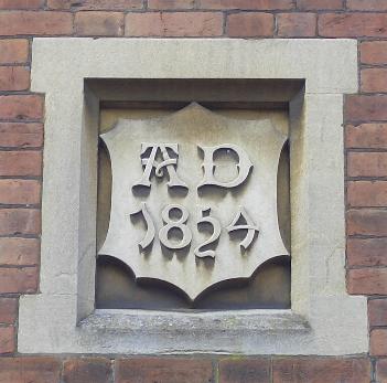
The date plaque on the front wall of the school |
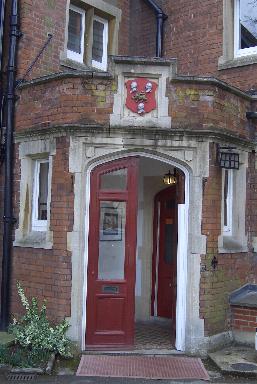
Coat of arms over the front door |
|
| History of the Building and Current Use | ||
|
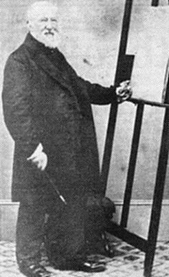
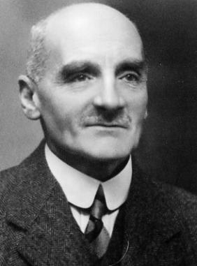
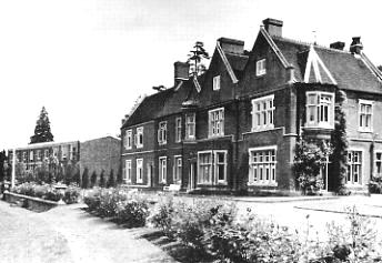
The building called ‘Sunnyside’ that now houses Reigate St Mary’s Preparatory and Choir School Preparatory School has a date upon it of 1854. It is named 'Sunnyside' in spite of the fact that the Borough Council has allocated the same name to a neighbouring property. Its earliest occupant was possibly James Farquhar – he may have built the house. He came from Hall Green in what was Kincardineshire, and there are quite a lot of places called Sunnyside in Scotland. In Reigate he was a local magistrate, Churchwarden at St. Mary’s and Treasurer to The Brockham Home for Workhouse Children. He married twice: (i) Anne Sladen in 1835 – she died in 1862 after bearing 5 sons; (ii) Diana Octavia Scott, born 24th May, 1829, at Ashton Upon Mersey, Cheshire; and married on 29th April, 1863, at Kinneff and Caterline, Kincardine, Scotland, who bore him three or four daughters, and at least two more sons. He died in 1875. His widow, Diana, lived on at “Sunnyside” until her death.
It was later the home of Godfrey
Searle, a stockbroker who became a Freeman of the Borough
c1950. He may have lived there from the early 190%s, was
definitely there in the 1930s and died there in
1958. Godfrey James Searle was the grandson of
James Searle, the second Mayor of Reigate His father was also James (see 'People of 1887' page on this website), a stockbroker who lived at ‘Eversfield’ with his wife Edith Eleanor (died 1923, aged 76), daughters Constance, Mabel, Florence & Blanche and of course Godfrey, who was born 1874/75. James died in 1894, aged 53.
Godfrey Searle, himself a singer at
St Paul’s cathedral, founded the Reigate St
Mary’s Boys’ Choir. Choral Scholarships were
awarded to the chorister-boys entitling them to free
education at the Grammar School up to the age of 16. If a
boy lost his voice before this age he was still allowed
to retain his scholarship at the school. The cost was
borne by Mr Searle. Until 1949, the boys’ education
from age 8-13 took place in either in the Grammar
School’s Preparatory Department (or the Grammar
School itself) that was then housed in the Friends
Meeting House, now demolished and rebuilt, in the Reigate
Road at the top of what is popularly known Grammar School
Hill. Once the 1944 Education Act came into force state
schools were no longer allowed to have fee-paying
departments so the Preparatory Department was hived off
into a separate school known as the Reigate St
Mary’s Preparatory School. The boys’ choir
continued to rehearse under Mr. Searle’s direction
in his house until his death in 1958. In the 1930’s
Mr. Searle had set up a charitable trust to continue his
work after his death, so in 1958 the Choir Trustees
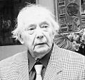
became the owner of the Sunnyside mansion and the surrounding grounds. In his will, Mr Searle had stipulated that his mansion should be made available to the preparatory school at a peppercorn rent of £50 for 99 years. The Trustees therefore offered the use of the mansion to the School. This offer was accepted and the preparatory school moved into the building in 1961(but see emails below re this date) and has remained there ever since. However, the School and the Choir remained separate entities, although working together. Mr Searle had wished the school to develop into a Choir School like those attached to some major cathedrals. In 2000 this wish was fulfilled, when the Choir Trustees bought the school business and renamed it “Reigate St Mary’s Preparatory & Choir School. A number of efforts were made in the intervening years to unite the two entities, and these efforts ultimately came to fruition when the Grammar School bought the School business from the Trustees in 2003 and merged it with the Grammar School as its preparatory department, the school thereby returning to its roots. The choir consists of between 13 and 16 boys and sings two matins services, which act as the school assemblies, and two evensongs a week during term-time. It also sings occasional services at other neighbouring churches and is available for weddings and funerals on request (and for payment!). The underparts are sung by professional singers from the major cathedral or church choirs in London. It enjoys an extremely high reputation and is considered to be among the best boys’ choirs in the country, having been invited to sing at Westminster Cathedral, Westminster Abbey, St Paul’s (in the past) and other City churches. (Grateful thanks to Mr Sean Hawkins and Mr Peter Turner for the above information) Godfrey Searle in 1936 Email received from Bill Perry. I have enjoyed
looking at the Reigate section of your website. The only
thing I can question is in the item about Chart Lane.
It's regarding the starting date of Reigate St Mary's
Preparatory School in Sunnyside. I arrived in the town
with my family in November 1959, and started school there
in January 1960 when it was all freshly painted with
Reverend Hobson as headmaster and Mr Salmon as deputy.
Your article says the school moved in, in 1961. I think
that is a year out. Didn't know a lot of the other
information about the school so it was very interesting. Thanks, Bill. My source said 1961 but if you were there in 1960 then that must be the correct date. I've left the 1961 date in situ but put a note against it referring to your email. AJM Email received from Peter Miles. I can confirm what Bill Perry says. I went to St Mary's (in its Sunnyside home) from September 1960 to the Summer of 1963 so it was certainly in situ by 1960. My hunch is that the move may have been before that as, despite Bill's comments about it being newly painted, it had a lived in feel and I am fairly sure that my classmates, most of whom had started there a year earlier than me, had been taught at Sunnyside. I'm sure a quick flick through the phone book would confirm this further as I was there with sons of some noted Reigate families such as Finch (bike shop opposite the Priory), Hyett (the town printers for several generations and Powell (headmaster of the school at the top of the town, with the local gunsmiths also being in the family). Mainly for sporting purposes,
all the boys were allocated to one of two houses, Searle
or Malcomson. One mystery here. Each year, Mr Two other details. First, I
remember when the school bought the field across the
twitten. It was (sort of) levelled by bulldozer but then
all the boys were given a bucket and formed into a line
which swept back-breakingly across picking stones. This
went on once a week for several weeks until, I think,
various fee paying parents made their thoughts known.
Secondly, what you refer to as St Mary's Walk was
universally known by all the boys as DMA, which stood for
Dog's Muck Alley. Thank you very much, Peter, for the confirmation and additional information. Research throws up quite a lot of material but there's nothing like first hand knowledge. Information from Robert Holton. I may be able to shed some further light on issues to do with the history of Reigate St Mary.s School and Choir. I attended the school from around 1954 to 1958, and after a successful voice trial/audition with Godfrey Searle in Sunnyside became a member of the Church Choir from around 1955 to 1959. I was choral exhibitioner at some point during these years, which came with a remission of fees I believe I left the St Marys School in
the summer of 1958 to go to the Grammar School, and I can
say that the move from the old Meeting House to Sunnyside
must have been later than July 1958. Judging from what
your other correspondents say the move must have been at
some point between autumn 1958 and the end of 1959. On the issue of the boys being
taken to see cricket in London, I remember going to the
Oval on one occasion and Lords on another, and I believe
we were taken by Mr Malcomson not Mr Searle. The six boys
to go were selcted from the cricket team - at least in
the 1950's, not from any particular house. At the Oval we
watched the 1957 West Indies touring team play the
wonderful Surrey team of that era On the choir itself, it should
be pointed out that most of the rehearsals were held in
the church vestry not in Sunnyside. There was a good
piano in the vestry, and that's where the sheet music was
kept. The choir was of an excellent
standard. I remember a group of us going up to London by
train to sing in St Pauls Cathedral. The performance was
of St Matthews Passion by Bach- a very memorable
experience. Our choir has pride of place at the front of
the trebles in the Cathedral, and we were excused from
attending rehearsals over previous weeks in view of our
reputation. Of Mr Searle, I remember a very
moving moment when he showed me a small casket in which
were kept the last letters to him from former choristers
subsequently killed in The First or Second World Wars.
The choir room in Sunnyside where we met up before
services, had a board on which were listed the names of
former choir members, which from by failing memory went
back well before the First World War. The choirboys sang at many
weddings and funerals for five shillings each. These sums
were kept and given to us in a lump sum when we left. I
bought a telescope with my lump sum from a shop at the
top of Church street The choirboys also played
cricket in summer and football in winter on Saturday
afternoon on the ground next to Churchfields bowling
greens behind the old bus station. Godfrey Searle was also buried
in St Marys churchyard close to the back of the Grammar
School. It was a sad and tearful day when we choirboys
stood around his grave. The choir was then taken over by
Mr Nuttall who I believe was Professor of the Organ at
the Royal School of Music. |
||
 |
 |
|
|
St Mary's Preparatory School viewed from the rear c1969. Next to it is St Mary's Church Hall. |
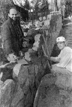
The wall at the front of St Mary's Prep School being rebuilt in 1993 after tree roots had undermined the original 130 year-old wall |
|
|
 |
|
|
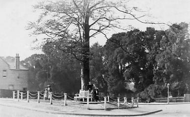
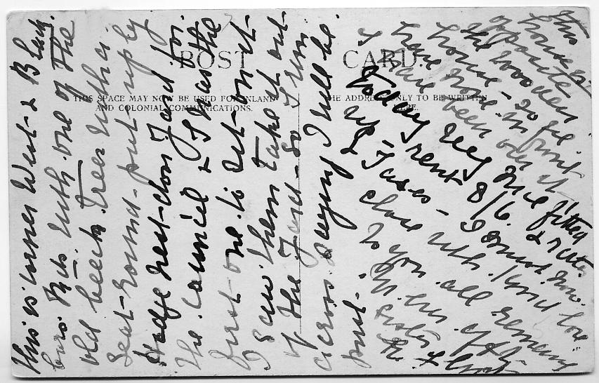
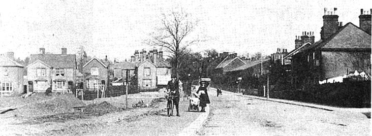
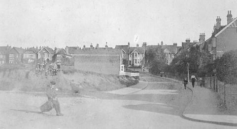
Another glance at the map reminds us that Chart Lane crosses West Road and continues on its south side. The above picture from an unknown date, possibly 1920s, is of the island that is situated at the south end of the northern part of Chart Lane. Orientation is not certain but it would appear that the northern part of Chart Lane comes from St Mary's Church to this point and passes either side of the island. To the right, following the corner around by the lamppost, is Blackborough Road; on the photographer's hard left would be Lesbourne Road. Chart Lane continues south across the road in line with the island. The picture is from a postcard and the message on the back reads: - This is corner West and Blackborough Roads with one of the old beech trees with a seat round put up by Hodge next door's yard for the Council and I was the first one to sit on it. I saw them take it out of the yard so I ran across saying I will be first.' It goes on: - ' This house is opposite the Rookery House . . . . ' There is more but it is difficult to read. The card is signed 'with love' and the signature looks like E.F.Crisp (or Crust). The caption on the postcard is THE NEW TRIANGLE, indicating that the island was also new, as borne out perhaps by its neat appearance. (Note: - John Hodge & Son's yard was between 9 and 11 West Road) |
||
|
Email received from Jan Burbridge on the above: - Just a quick note on the orientation of the photo above. Having lived in Blackborough Road for 13 years (recently moved) I can recognise this junction's orientation from, believe it or not, the direction of the sunlight. The photographer is facing roughly northwest. The road leading away to the top left (at about '11 o'clock') is West Road. The road leading off to the far right (at about '2 o'clock') is Chart Lane, leading to St Mary's church. The continuation of West Road, becoming Blackborough Road, disappears off behind us to the right (at about '4 o'clock'). The two standing figures, who seem to be far away at the back of the island, would today be obscured by the bus stop. The sun spends most of its day travelling across the south shining directly into the front windows of the houses on the north side of Blackborough Road (and fading my upholstery!) - ie the same alignment as the near left set of posts and chain. If we could swing the camera a little to the right, we would see the corner shop and the row of Victorian houses leading off up Chart Lane to the North.
The wooded area of land to the rear appears to slope away slightly,downhill, which would be correct if heading towards 'Lesbourne Fields' and indeed the Les Bourne itself - the stream which once crossed the area behind the prep-school, draining into the Wray Brook, and from which the fields were named. Presumably then it was part of the Sunnyside nursery site. Of course I could be wrong! but I hope this is helpful. Thanks, Jan, it is indeed helpful - AJM |
||
 |
||
|
The undeciphered part of the card (as mentioned above). The great shame with this card is that it was not postally used so it is not immediately possible to know the likely year of the installation of the island and seat. In the picture below, taken on Boxing Day 1927, the seat is visible on the far left, so the date of its installation is before then. Betty Severn kindly sent in this
translation of the above card.
And
this from Jan Burbridge: About the difficult-to-read postcard
from
'Mrs Flint' and her reference to the 'Woodley' or
'Woolley' house. On reading this through myself, without
reference to the translations, I read this without
hesitation, as 'wooden' (see the other 'n's'). I recall
that there was a Victorian-ish period, ship-lap-boarded
house on West Road, opposite what must be the yard
building in the background of the photo. As far as I can
recall, it was owned by Goodrich & Saunders when I
was a girl at school in Reigate (1970's), was dilapidated
when I moved to Blackborough Road (1991) and is now
pulled down and replaced by two sem-detached houses,
built in keeping with the Victorian semi's beside them.
Could this be what the mystery word is referring to?
|
||
Picture courtesy oldreigate.com |
||
 |
||
|
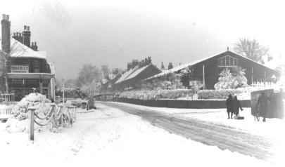
This picture is very similar to the one above except that it shows a wider view from a little further back from the crossroads. It is a little difficult to recognise immediately because of the open space on the left where building work was going on at the time. The date of this picture is unknown. (picture courtesy Surrey Mirror) |
||
 |
 |
|
|
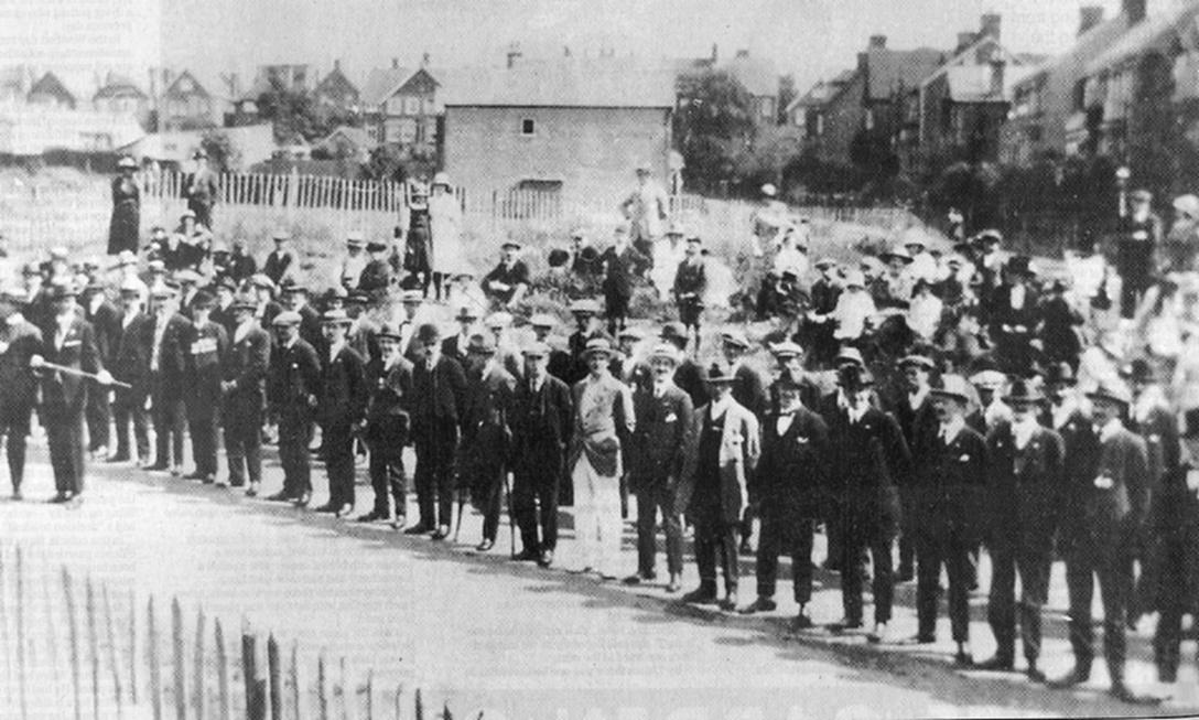
A parade of ex-servicemen in a ceremony connected with the building of the ex-servicemen's club on ground on the corner of Chartfield Road and Chart Lane c1921 (the men are facing the plot which is out of picture). Notice how the ground behind the men has not yet been developed (see also next picture). |
A view up Chart Lane probably in the mid-1920s. The road on the left is Chartfield Road and the road on the right is Glovers Road. The picture has been taken from almost the same spot as the picture on the left. Some development has taken place as here the building behind the men in the picture on the left has been replaced by (or converted into) a house. |
|
 |
 |
|
|
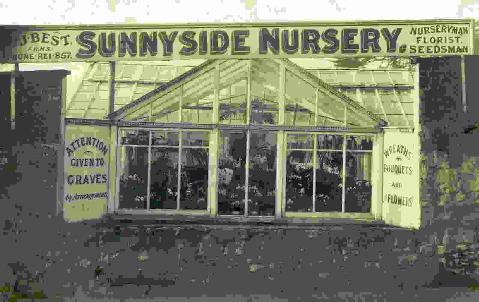
A sadly damaged picture of the Sunnyside nurseries that used to be on the west side of the north part of Chart Lane |
The ex-servicemen's club in Chartfield Road as it is today |
|
 |
 |
|
|
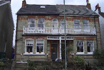
Number 42 Chart Lane pictured in 1916 when it was the home of Harry and Eunice Britt. Presumably that's Harry on the front steps. Perhaps the lady at the front door is Eunice but who the lady on the balcony would be is unknown. The house is on the right hand side of the road in other pictures above so perhaps the grass in the foreground is that on the vacant site on the left. (Image reproduced by kind permission of its owner) |
The pair of houses as they appear today. Number 42 on the left has been re-roofed and has lost is decorative ridge tiles, the ivy over its front and the shutters have also gone. Otherwise the houses retain their balconied charm. |
|
 |
||
|
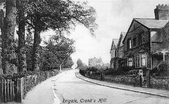
Although entitled Cronks Hill this is the upper part of Chart Lane leading to Meadvale. Peter Benthom kindly contacted me to advise that the houses pictured are numbers 92-98 Chart Lane, and that the next house, no.100, was built in 1906 |
||
|
130725 |
||