

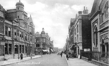
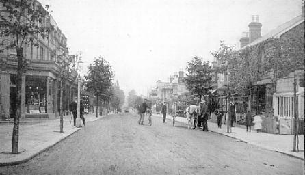
Redhill as it once was and as it is today - London Road
|
A brief word of explanation because of town centre pedestrianisation the London Road doesn't become an actual traffic carrying road at the town centre any more, it starts several hundred yards north at the Lombard roundabout. And the new road that was built from the junction of Warwick Road with Station Road West, and which takes most of the route of the old Clarendon Road South and some of the old London Road as far as the Lombard roundabout, is called 'Queensway'. Confused? If you've been away for a while you soon will be. First, let's have a look at how the town centre (where London Road starts) has changed |
||
 |
 |
|
 |
||
|
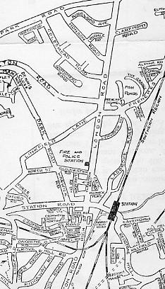
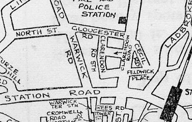
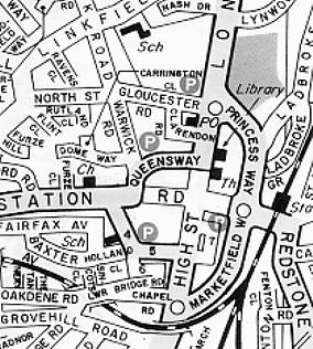
Redhill as it was and is today The left hand map above shows the straight section of London Road striking north from the crossroads at the centre of the town near the railway station to its junction with Gatton Park Road at the very top of the map. The enlarged upper right hand map shows some of the small streets off London Road close to the town. The lower right hand map shows slightly more of the town centre and includes the new roads (Queensway; Princes Way; Marketfield Way and a new route where Cromwell Road once was) that create one way circular system around the town. Much of the centre of the town contained within this ring system has been pedestrianised. |
||
|
|
||
|
The aerial picture is not the best way to look at London Road, which extends for some considerable distance northwards beyond the limits of the photo. So we shall look at the road as it once was and how it is today starting from its southern end at the town centre.. |
||
 |
 |
|
|
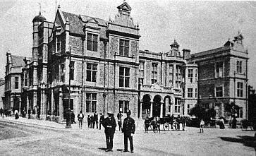
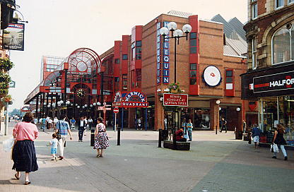
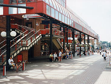
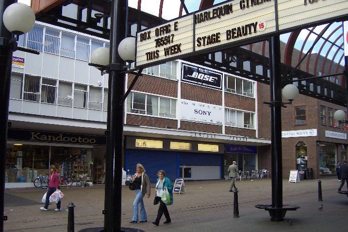
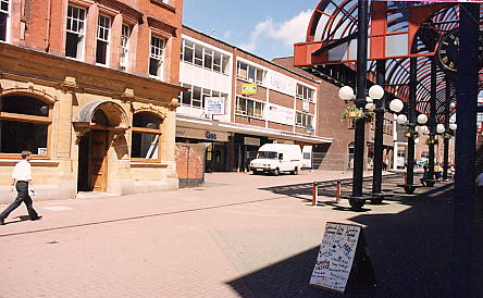
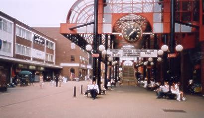
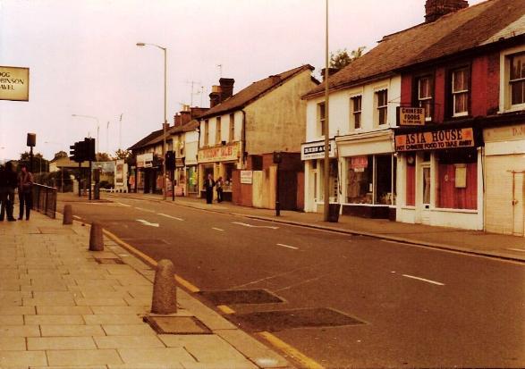
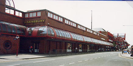
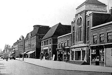
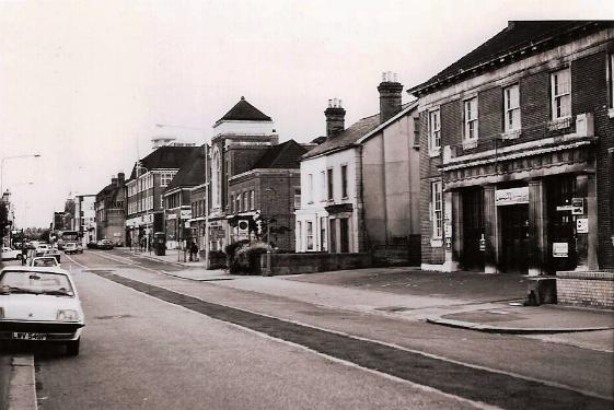
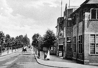
London Road viewed from the High Street. Left is the Market Hall, which stood from 1861 until 1982. It was a central point in the town and a landmark that many remember. It was replaced by the Warwick Quadrant. The picture on the right was taken from the same viewpoint as the picture on the left. It shows the Warwick Quadrant complex, which contains a theatre and cinema at its southern end and Sainsbury's supermarket with Redhill's library over at its northern end. Many people mourn the passing of the old building but the Harlequin Theatre is a great asset to the town. Sainsbury's, however, is far too small and the library is up two flights of steps. There are lifts but these are claustrophobic and I have twice seen them broken down with people trapped inside. The result is that the library is a no-go area for some elderly people. It will not escape notice that in the lefthand picture the town centre was a crossroads with the requirement for a policeman to direct the traffic before traffic lights were installed in the early 1930s, whereas in the righthand picture the town centre has been pedestrianised, with the roads now diverted around the town. The town centre used to be called the Marketplace, in 2004 it was renamed 'Maple Square' after maple trees planted in the High Street. The old name was not officialy rescinded nor has the new name been posted up. To all effects the town centre is now anonymous. To make matters worse, in a 'let's do something for Redhill' mood, the Council has replaced the red brick surface of the pedestrianised area with a very light coloured stone that shows every dirty mark. The overall effect is disappointing and a backward step. Although not strictly proper to this page, mention of the Belfry shopping centre is appropriate, as it now houses many shops that would otherwise be in the open areas of the town. Shopping malls do have some good points but, because of the Belfry, Redhill suffers from a dull appearance in its open street areas, with closed and unused shop premises and many charity shops, a syndrome of many English towns. It is difficult to fully assess the effect on the town as Reigate, which is not pedestrianised and does not have a shopping mall, suffers from the noise of constant through traffic and the consequential road crossing problems for shoppers, making it another no-go area for many elderly people. |
||
 |
 |
|
|
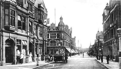
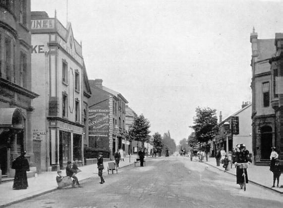
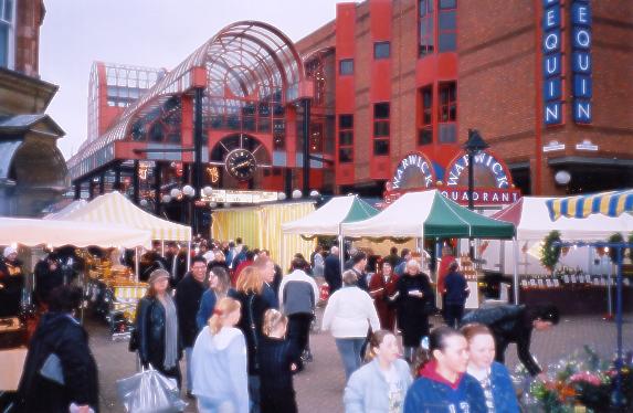
Seen from the other direction we see the side of the old Market Hall (on the left in the 1920s view from London Road across the centre of the town and south down the High Street) had entrances to chambers and offices and was once home to the Post Office (lady posting a letter) until it moved to the corner of Clarendon Road in the early 1930s. The scene today is greatly changed. The steps in the right hand picture are the previously mentioned ones that lead to the theatre and the library, and in the lower part of the building, under the canopy, are shops. The pedestrianised area is occupied by a market three days a week, which if you like markets is great, but if not just makes movement around the town difficult. |
||
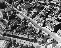 To orientate
the viewer to this 1960s aerial picture of the town end
of London Road, the town centre is top left of picture
with the buildings on the west (Reigate) side facing the
camera. The large building right of picture is the Co-op,
the Post Office is on its right, the northern part of
Clarendon Road between the two. Working back to the
centre of the town we see on the other side of the Co-op
a row of shops to the southern part of Clarendon Road
with the Queens Arms pub on its other corner. There are
more shops and then the large roofed building is the
Baptist Chapel. Then there is the building that once
belonged to Bartons the wine merchants, and then the
Lloyds Bank building on the corner of Station Road West
at the town centre. Opposite and top left of picture on
the corner of London Road and Station Road East is the
Market Hall. The buildings along this side of London Road
are shops and the Sultan pub all the way to Cecil Road,
which can be seen at the bottom of the picture. The
Harlequin, Sainsburys and Lombards occupy this side of
the road now and apart from to PO and Lloyds bank all of
the other buildings are gone.
To orientate
the viewer to this 1960s aerial picture of the town end
of London Road, the town centre is top left of picture
with the buildings on the west (Reigate) side facing the
camera. The large building right of picture is the Co-op,
the Post Office is on its right, the northern part of
Clarendon Road between the two. Working back to the
centre of the town we see on the other side of the Co-op
a row of shops to the southern part of Clarendon Road
with the Queens Arms pub on its other corner. There are
more shops and then the large roofed building is the
Baptist Chapel. Then there is the building that once
belonged to Bartons the wine merchants, and then the
Lloyds Bank building on the corner of Station Road West
at the town centre. Opposite and top left of picture on
the corner of London Road and Station Road East is the
Market Hall. The buildings along this side of London Road
are shops and the Sultan pub all the way to Cecil Road,
which can be seen at the bottom of the picture. The
Harlequin, Sainsburys and Lombards occupy this side of
the road now and apart from to PO and Lloyds bank all of
the other buildings are gone.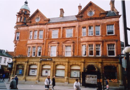 |
|
The address of Lloyds Bank is No.1 London Road |
 |
 |
|
|
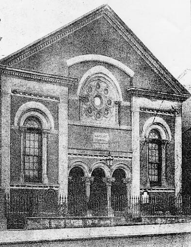
Another wide-angle view of London Road close to the town centre. The building on the right with the ligher front is that of J.R.Clarke, wine and beer merchants. Far right is the Baptist Chapel that stood in London Road for over ninety years. |
The Baptists began their activities in the Market Hall before settling in their chapel in London Road in 1866, a site that in 1999 was the site of Boots' opticians, Tru-Fi etc. The situation was a perfectly good one in 1866 but the road that once passed its door became too busy and the congregation sold up and built a new church in Hatchlands Road in 1959. |
|
 |
 |
|
|
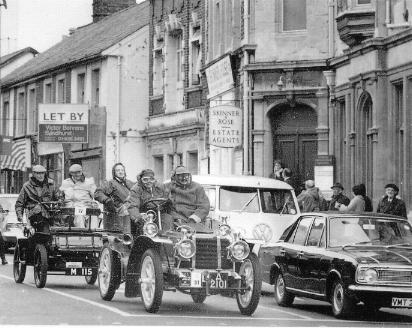
Cars on the 'Old Crocks' London to Brighton run in the 1960s wait at the traffic lights at the centre of town. Note the old town centre toilets in the centre background. The door into the side of Market Hall gave access to a staircase to the small hall on the first floor. |
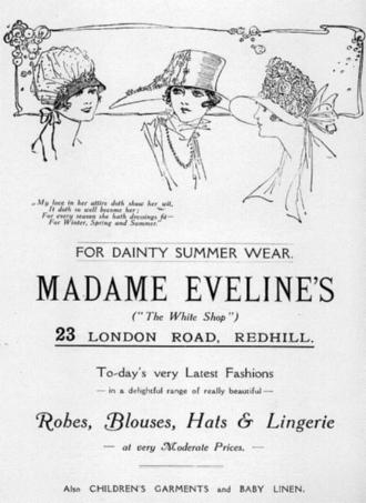
Shop advert from the 1920s or 1930s |
 |
 |
|
|
Clarke's shop was replaced as was the chapel and the small parade of shops that replaced them were set back as though a new building line was to be established on the west side of the London Road, but little other rebuilding was undertaken and today the shops still sit back as though separated from their neighbours. The shop on the left was formerly Boot's spectacle shop and the one on the right still (March 2005) shows its Tru-Fi name although it has been closed since autumn 2004. RH picture taken from further away than LH picture. |
||
 |
 |
|
|
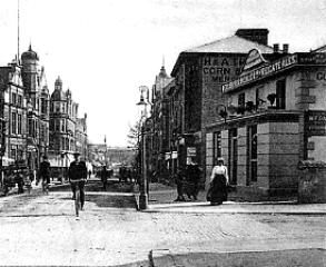
The view north from the southern end of London Road in the early 1900s |
The view north from the southern end of London Road in 2003. The steps lead to library and Harlequin Theatre |
|
 |
||
|
The market takes place on several days each week and is spread about the town centre and into Station Road. |
 |
 |
|
|
The Queens pub once stood at the corner of London Road and Clarendon Road South. |
On the east side of London Road, opposite the Queens, stood a long row of small shops. This view is looking south, the trees on the left by the horse and carriage were once a feature of the town. |
|
 |
 |
|
|
Looking north, the shops on the east side stretched as a far as Cecil Road and on the west side as far as Gloucester Road. |
Another view of shops on the east side of the road in the 1970s (Photo courtesy Jane Smith) |
 |
 |
|
This photo, although taken from
the opposite direction to the one above, shows the east
side of London Road after all the old shops had been
demolished. (photo courtesy Jane Smith) |
They shops in the pictures above and left have been replaced by the Harlequin Theatre and library, Sainsburys and the Lombards building. |
 |
 |
|
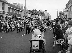
Many people will remember the Sultan pub that stood of the east side of London Road not much further along than the pictures above. Before this part of the town was demolished the pub itself was knocked down and rebuilt and is seen here in this carnival picture in its 1970s form |
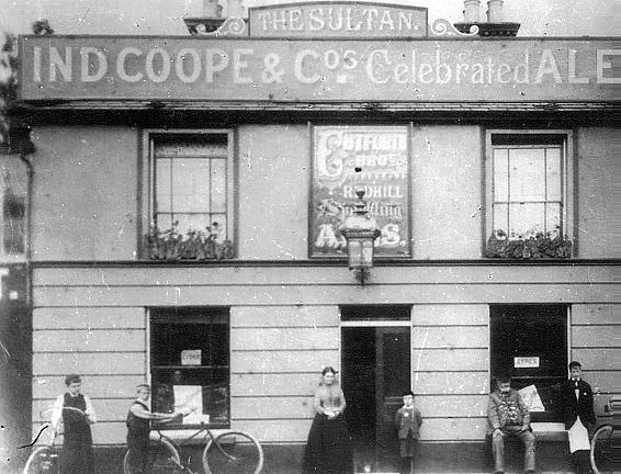
The Sultan pub as originally built in the Victorian era. |
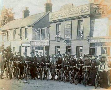 |
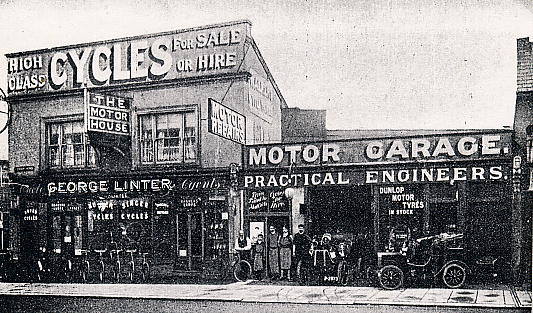
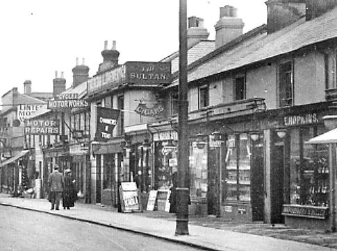
In this picture the Sultan pub is in the background with Linters' premises on either side. In the foreground a group of cyclists, possibly a loca club, pose for the photographer. (Photo kindly sent in by George Smith from Lincolnshire) |
 |
 |
|
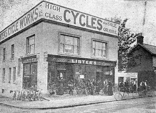
Linters shop used to be next to the Sultan but moved to a new position alongside Cecil Road. The first picture shows the premises when only bicycles were sold, the second picture after cars began to be sold as well. Now both Linters and Cecil Road are no more and Lombard's offices stand on the site |
|
|
There is much more information and many more pictures in a page devoted to the Linter family and their business in Redhill. It is in the family section (section 4) of this website. To see it go to the index page section 4, local families, or Linter family page |
|
 |
 |
|
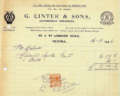
A bill from Linters for the purchase of a bicycle in 1926. The bell cost 2/- |
The Lombard North office block occupies a larde section of this part of London Road |
 |
 |
|
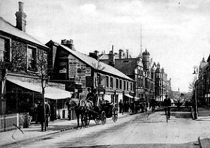
The part of London Road seen in the last few pictures in the early 190%s when trees adorned it route |
Almost exactly the same view in the 1920s or 30s, by which time the trees were no more |
 |
 |
|
A closer view of some of the old Victorian shops in the two pictures above. E.Hopkins shop is on the right and the original Sultan pub, as mentioned above, is further along. immediately before the Sultan is the Cylist's Rest, a tea shop. Beyond the pub are Linters cycling and motor premises. |
Some of the 1930s shops on the east side of London Road from Clarendon Road south onward towards the Co-op |
 |
 |
|
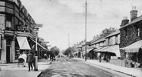
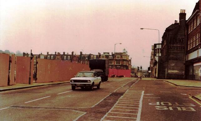
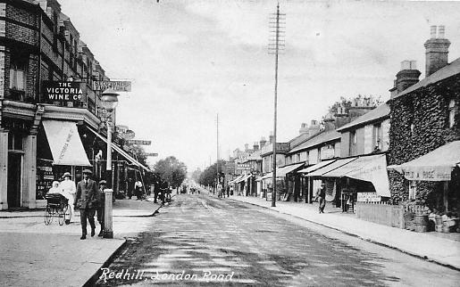
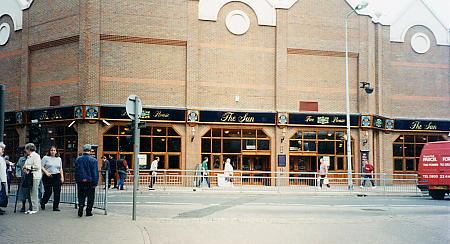
Where the shops on the left of the previous picture once stood a new pub has been built. It stands on the corner opposite the old Queens Arms. Remembering that old pub, and as the new road passing it is now called 'Queensway', the name 'Queens' springs to mind - but it's called 'The Sun'. It occupys the whole of the corner where the Victoria Wine Company stood. The red van on the right has just come around the one-way system and is heading north on the London Road. |
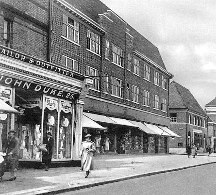
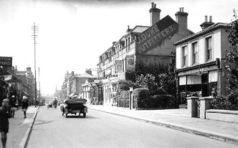
The last of the shops in the above picture was John Duke's outfitting shop. Next to it was built the Co-op and, on the other side of Clarendon Road north, the Post Office, built in 1934 but now a restaurant with flats above and about to be built behind. |
 |
 |
|
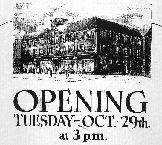
The advert for the opening of the Co-op in London Road in 1935. |
Looking back in the opposite direction from the previous picture, and at an earlier time, we see Dukes the outfitters before the Co-op was built next to it, The site was then occupied by houses, one of which (far right) was at this time in use by Strong Brothers, who were umbrella makers |
 |
 |
|
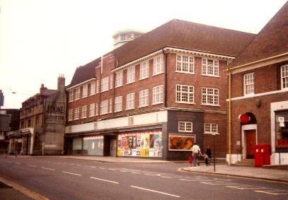
The Co-op only recently closed in the 1980s (picture Brian Burrows) |
An imposing building from any angle (picture Brian Burrows) |
 |
 |
|
As time went on it began to be an eyesore |
Scaffolded awaiting demolition (picture Brian Burrows) |
 |
 |
|
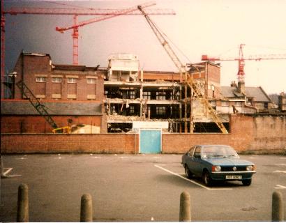
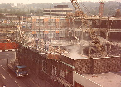
Crane city - demolition begins (picture Brian Burrows) |
Demolition well advanced. Picture taken from the roof of the Clarendon Road telephone exchange |
 |
|
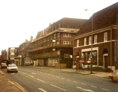
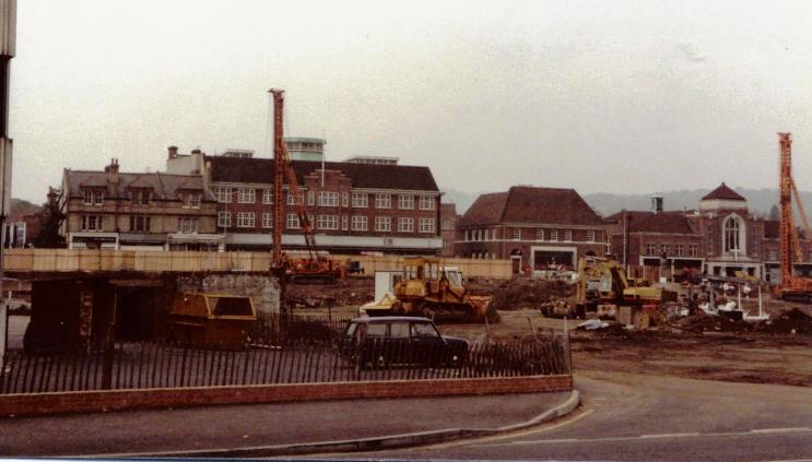
A view of London Road taken from near the Surrey Mirror building in about 1983. The old Central Hall is on the right with the Post Office next to it. Clarendon Road is between the Post Office and the still standing Co-op building with its distinctictive green cupola on its roof. Next to the Co-op are the shops that stood next to the junction of London Road with Clarendon Road South, now Princess Way. (Picture courtesy Lin Pugh) |
 |
 |
|
|
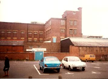
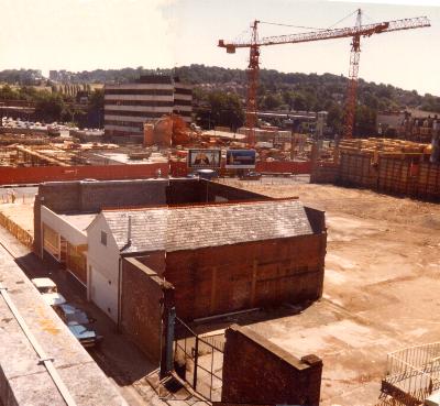
In this 1984 composite picture, taken from the top of the old telephone Exchange in Clarendon Road, the Co-op is completely demolished, as is most of the north-east quadrant of Redhill across the other side of London Road apart from the old Surrey Mirror office building. All that remains of the Co-op is walls on two sides of the Coral betting office, the store next to it, and the gates that were the Co-op's rear entrance where deliveries were made. |
On the other (north) side of Clarendon Road from the Co-op stood the Post Office and the Methodist Central Hall with a number of shops in its frontage |
|
 |
||
|
This photo shows the buildings
from the fire station to the Co-op and beyond as they
were in the 1970s (Photo courtesy Jane Smith) |
||
|
|
 |
|
|
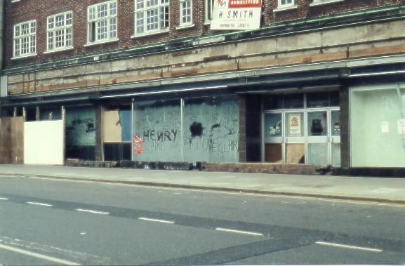
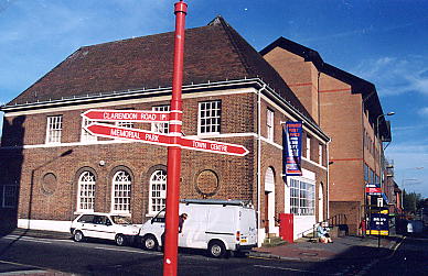
The Post Office moved to the new shopping mall in the Belfry the old building is for sale it the above picture. The finger post in the foreground is one of those 'enhancements' supplied by the Council that just fail to achieve the desired effect. The one pointing to the left correctly says 'Clarendon Road' but the other two indicate the Town Centre and the Memorial Park in the opposite directions to which they actually are. |
The old Post Office is now a restuarant called Prezzo. The Post Office was built in 1931 on the site of a home occupied by the Christian Alliance of Women and Girls. |
|
 |
 |
|
|
The old Methodist Central Hall, on the corner of London and Gloucester Roads, was completely demolished and rebuilt. The new methodist Central Hall, here seen from the same angle, is much larger and completely dominated the Post Office next to it. Both Post Office and Methodist Hall were built in 1934, suggesting that the whole plot bounded by London, Gloucester and Clarendon Roads was largely undeveloped before this. Its history is of a single house having occupied the spot on the corner diagonally opposite to the spot where the Methodist Hall was built. Lived in by Mr Gatland, who owned the men's outfitters in the High Street, it also later accomodated the Redhill Bowling Club. Before the Methodist Hall was enlarged part of its green could still be seen from Clarendon Road. |
||
 |
||
|
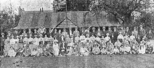
The bowls club was in Gloucester Road, just yards from the London Road. In 1915 wounded soldiers were entertained by club members |
||
 |
 |
|
|
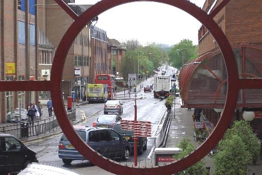
Looking north up London Road on a rainy day from the top of the Harlequin steps through part of the building's decorative ironwork. The red bus is standing in front of the buildings that have replaced to old Central Hall. (picture taken May 2005) |
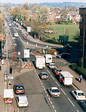
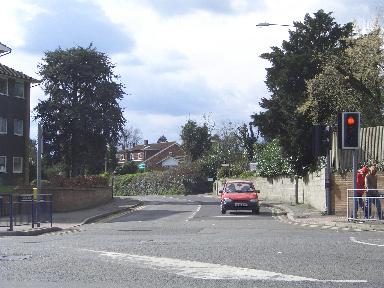
At the junction of London Road with Gloucester Road there is now a roundabout created as a part of the new road around the town. In the above picture the road off to the right leads to another roundabout at Station Road by the railway station Beyond the roundabout is the Sports Ground, once the home of Redhill football club. |
 |
 |
|
|
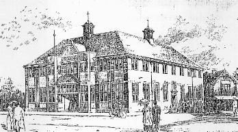
The Colman Institute stood just past Linters on the north corner of Cecil Road. It was demolished to make way for the roundabout and new road. |
The architect's impression of how the Colman Institute would look when built in 1904. |
|
 |
 |
|
|
A 1926 view across Redhill Sports Ground and the houses that used to stand on its west side (see aerial picture below) |
An almost identical view in 1994 showing new development on the west side of London Road |
|
 |
||
|
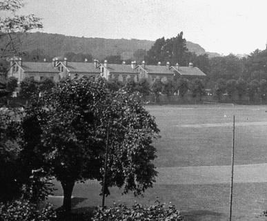
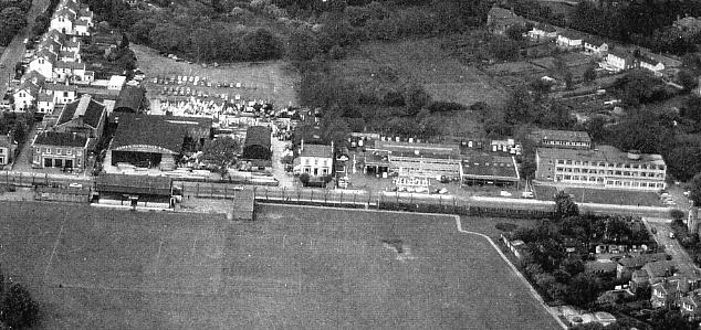
This 1967 aerial photo shows the sports ground with the London Road running from left to right just above picture centre (Redhill town centre is to the left) and some of the buildings that used to stand on its west side. These include the swimming baths far left with the fire and police stations at its front, Glanville's wood yard next to it, the only remaining house (one of a number that used to stand along the road, see above), Kennings garage and the Social Security building far right. |
||
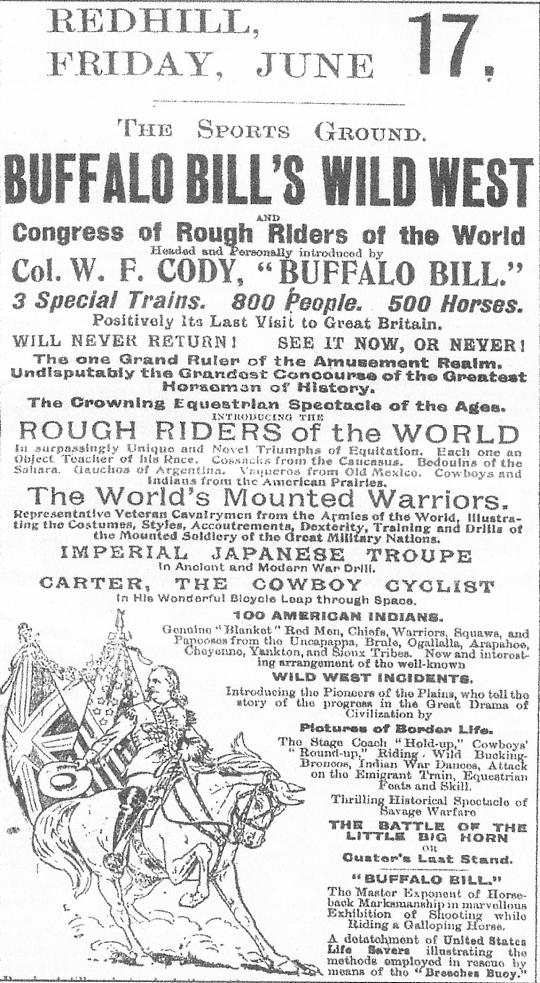
ABOVE - Buffalo Bill's Wild West Show came to England four times. 1904 was the year of its last tour and the only time that it came to Redhill Sports Ground. The Surrey Mirror reported how good the different shows were and how the people of Redhill and Reigate were impressed with the display of horsemanship. |
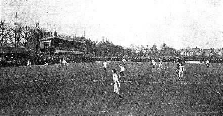
ABOVE - Redhill Football Club was originally based at Wiggie, a little to the north of Redhill but in 1896 the Redhill Sports Ground and Athletics Co. was formed on nine acres of ground fronting onto London Road. In the above 1920s picture the original stand can be seen.. |
|
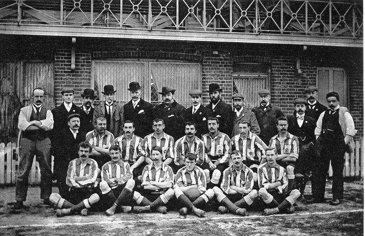
The 1899 Redhill football team in front of the original stand |
||
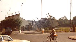
ABOVE - In 1929 a new stand was built and Redhill Football Club enjoyed many more years at the ground with good attendances. When the town was greatly redeveloped in the 1970s and 80s the club had to move and is now situated south of the town at Three Arch Road. This picture shows the stand being demolished in the 1980s. |
||
 |
 |
|
|
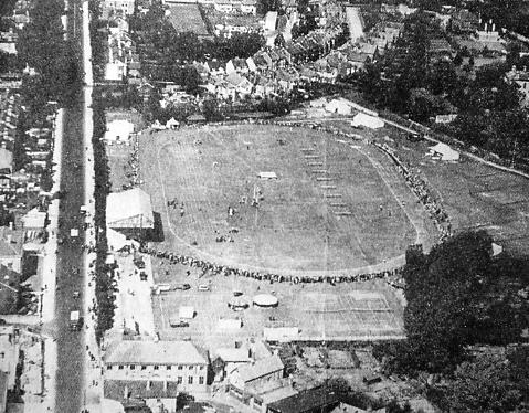
Looking north this aerial image shows a schools sports event in progress in the 1920s or 30s. The large building at the bottom of the picture is the Colman Institute. |
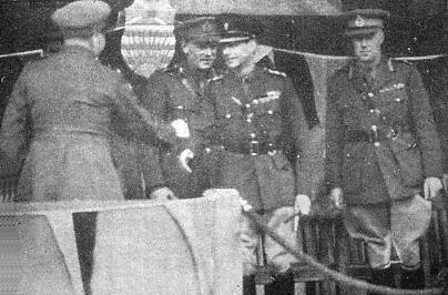
During WW2 King George VI came to Redhill Sports Ground for the Dominion Day Sports. Here he is seen at that event with Canadian officers. |
|
 |
 |
|
|
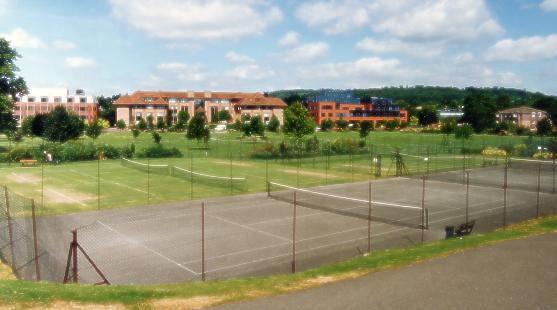
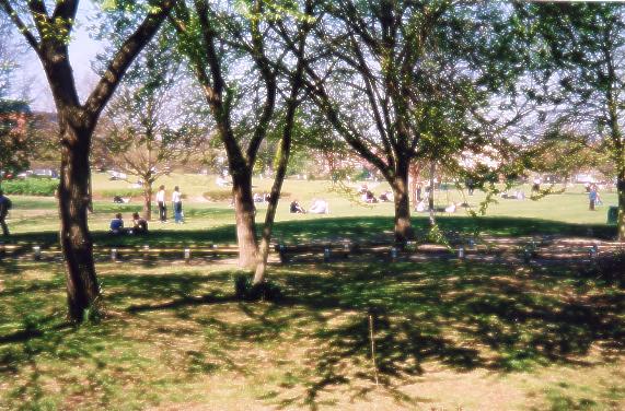
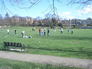
The Sports Ground ground is now a just a park. |
An impromptu game of football in the park on precisely the spot where Redhill FC played its matches for around seventy years |
|
 |
||
|
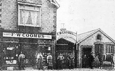
On the right of the Colman Institute in the picture above left is a small group of buildings that stood in Cecil Road. They were the premises of F.W.Coombs, oilman, ironmonger and farrier at Cecil House in Cecil Road. Cecil Road and the building ceased to exist when Redhill was redeveloped |
||
 |
 |
|
|
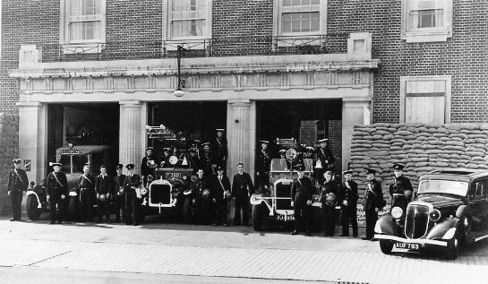
The picture on the left shows front of the fire station during WW2 with fire, police and ambulance personnel assembled.
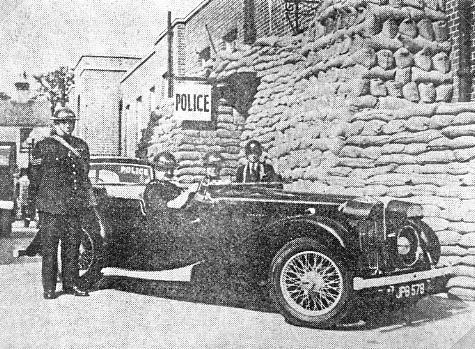
The police station was to the left of the fire station, and in the righthand picture police officers are wearing helmets alongside its heavily sandbagged entrance. The car is equipped with a loudspeaker and was used to tour the area issuing information, including warning of impending air raids when the siren on the Co-op roof froze in winter. The swimming baths were at the rear of the fire and police stations, the part of the building jutting out in the background was its entrance. |
||
 |
 |
|
|
Chigwell House once stood where the Department of Social Security buiding now stands opposite Lynwood Road. A doctor, W.H.Turner MD lived there in 1888 but ten years later it was the offices of the Ordnance Survey. In October 1913 the staff and their families, 120 men women and children, moved to Norwich. As the Ordnance Survey was a military endeavour the building remained in military use and during WW1 was used to house prisoners of war. |
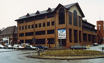
The Department of Social Security building now occupies the Chigwell House site and is pictures here in 2007. It is understood that most tasks carried out here are now done in Hastings and other points south of Redhill, and that staff still on site are liable to move at some time to leave the site to perhaps be redeveloped once more. Ex-Redhillian Peter Taylor advises me that since 2002 the DSS has been known as Jobcentre Plus. . |
|
 |
 |
|
|
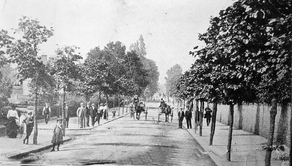
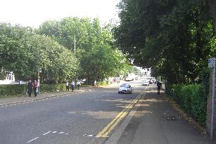
A view north along part of London Road in the early 190%s. |
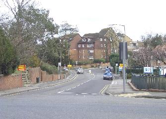
A view north up London Road to the crossroads formed with Linkfield Lane and Frenches Road where there are traffic lights today. The Department of Social Security building is on the left. |
|
 |
 |
|
|
Further along London Road, on the other (east) side at the crossroads, was the Water Company building. Probably erected in the 1930s it was made particularly attractive by the ivy that covered it. It has since been demolished (1990s) and replaced by a more modern structure. |
The present Water Company building |
|
|
|
 |
|
|
The Water Company offices are situated on the corner of London Road and Frenches Road. As already stated the junction is a crossroads as Linkfield Lane is opposite. The highway of which London Road is a part was made in 818 from Gatton Point to Povey Cross and created an alternative route south to the one through Reigate. Linkfield Lane and Frenches Road, however, are much older than this and once provided a route from points west through to Merstham and points north and east. The picture on the left is a 1906 view up Frenches Road to the crossroads, the one on the right is looking down the same stratch of Frenches Road from the crossroads at about the same time. |
||
 |
 |
|
|
A view up Frenches Road to London Road. The Water Company building is on the left. |
A view down Frenches Road from London Road. The large building is flats built where St Josephs School used to be. The Water Company is just out of sight on the right. |
|
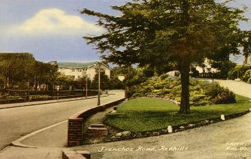 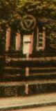
A slightly older picture of Frenches Road and its junction with London Road. It was taken when not only was the old Water Company building still on the corner but the old style road signs were still in use. One indicating a junction ahead is on the left side of the road and is also shown enlarged.
(Picture courtesy Bob Sargent) |
||
 |
 |
|
|
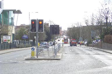
A view across the London Road of Linkfield Lane. |
A view south back to Redhill town from the junction of Frenches Road and Linkfield Lane with London Road. The Water Company building is on the left. |
|
 |
 |
|
|
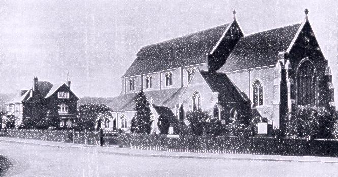
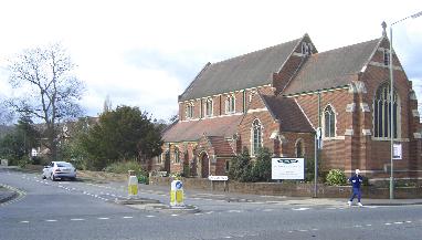
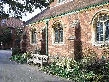
A little past the Crossroads Holy Trinity Church stands on the corner of Carlton Road. Shown here shortly after it was built and as it is today it is the road that has changed and not the church. The vicarage, seen on the left of the black and white picture, has been replaced by three houses. |
||
 |
 |
|
|
The seat alongside the Holy
Trinity Church was given by pupils of St Anne's in
memorium of the last headmistress there. 'To the dear memory of Miss J.M.Young, last headmistress of the Royal St Anne's School, Redhill, 1909-1919. This seat given by girls of the school 1964' |
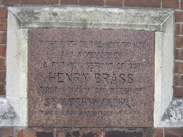
This plaque is set into the
front wall of the Holy Trinity Church. 'IN THE FAITH OF THE HOLY TRINITY AND IN MEMORY OF A FAITHFUL SERVANT OF GOD HENRY BRASS FIRST VICAR OF THE PARISH OF ST MARY'S REDHILL THIS CHURCH WAS ERECTED IN 1906'. |
|
 |
 |
|
|
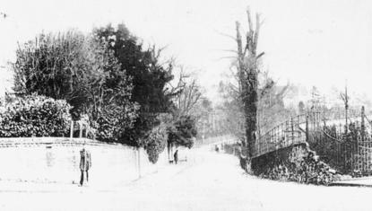
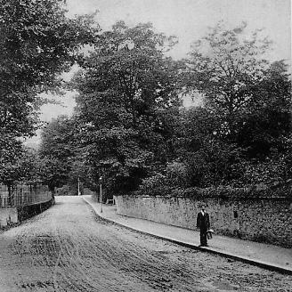
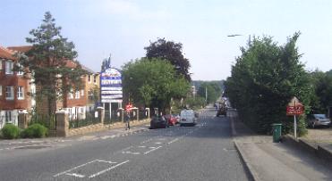
Beyond Holy Trinity the road continues to Gatton Point in the distance. Several houses were demolished in 2005 and the block of flats on the left of picture built. |
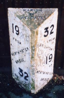
On the right hand side of London Road shown above is a milestone. It has 'Reigate Parish' inscribed on its top indicating that it was put in place before St John's Church, the first to take part of the Parish of Reigate away from Reigate's St Mary's Church, was built in 1843. Quite possibly it dates from the building of the road south from Gatton Point in 1818. |
|
|
Halfway along the righthand (east) side of London Road, shown in the above picture on the left, used to be the Southern Provincial Police Orphanage |
||
 |
 |
|
|
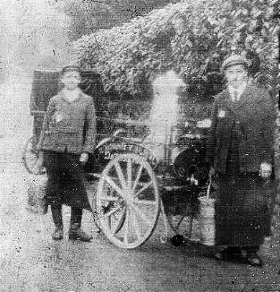
Milkman Tom Burrows on the left in London Road c1904 |
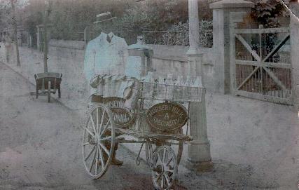
Milkman Tom Burrows in London Road c1914 |
|
|
The notice on the front of the milk cart in the picture on the right says 'Nursery milk a speciality'. (Picture courtesy Brian Burrows) |
||
 |
 |
|
|
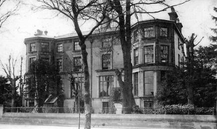
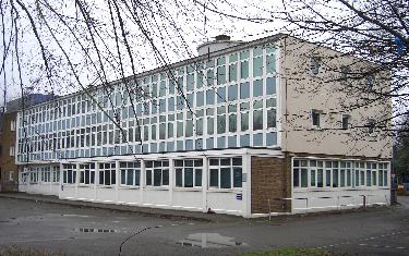
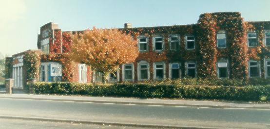
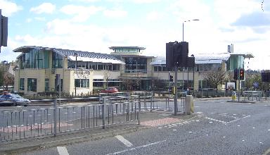
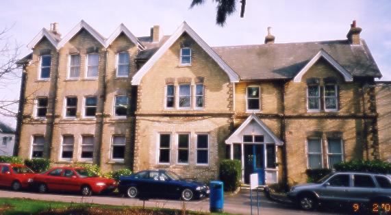
At the north eastern end of London Road is the old Hawthorns school building, now part of the East Surrey College complex |
The north side of the building showing part of the much more modern East Surrey College building behind it |
|
 |
 |
|
|
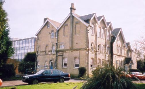
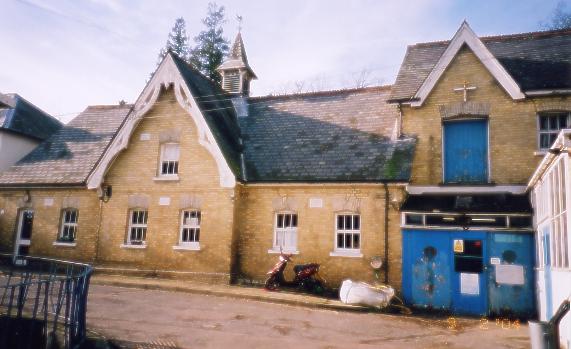
Some of the otherbuildings associated with the Hawthorns School |
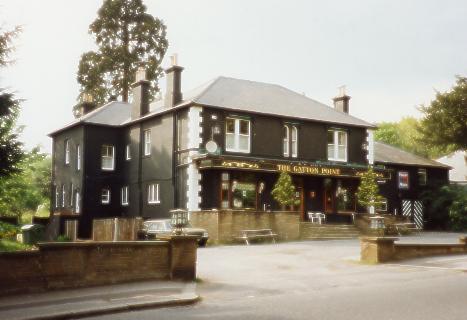
Opposite the East Surrey College / old Hawthorns School buildings used to be the Gatton Point pub, demolishedin 1997. The site is now occupied by a block of flats. |
|
 |
 |
|
|
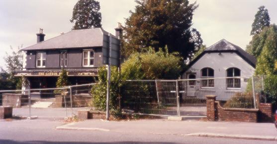
Next to the Gatton Point pub used to be a chapel that had a new use as business premises for some while before it was also demolished. |
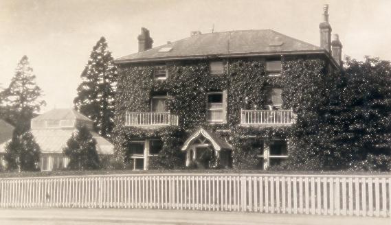
The ground beyond the Gatton Point pub and the chapel was once the site of The Lodge, a large house that is also no more, its grounds in part now being occupied by the Texaco petrol station on the north west corner of London Road and Gatton Park Road. |
|
|
There are roads off London Road that have not been mentioned on this site; perhaps they will be added at a later date. This page was considerably expanded in March 2007. |
||
Email received March 2001
My name is Vamsi and I think this web site is just great. From my name you might be wondering why I say this. Well I was in Redhill for a good 3 year period working in Lombard and now, back in India, was just feeling a bit nostalgic and searched the web for some good site on Redhill area. Was lovely to see some of the good ol' places and know a bit more abut the way it looked earlier. Great work and keep it up.'' ..............Vamsi - March 2001
Thanks for the encouragement Vamsi. Best wishes to you. AJM
This page is part of Alan Moore's website (formerly www.redhill-reigate-history.co.uk)
To see more Redhill and Reigate local history pages see the index page
10th August 2011